Sentinel Hub Custom Script Contest
Sentinel Hub is a platform that everyone can explore earth observation data with a free account. EO Browser, one of the free web applications on Sentinel Hub, allows users to browse satellite data easily from many satellites and data sources. EO Browser’s custom scripting is a powerful tool to analyze and visualize satellite data instantly.
The Copernicus EU Earth Observation programme, the European Space Agency and AI4EO consortium as a collective decided to source new creative remote sensing techniques and scripts by hosting a series of the Sentinel Hub Custom Script Contests worldwide. The first and second contests were in Spring 2019 and Winter 2019/2020 respectively. The third edition was held in summer 2020 and the result came out recently. The winners are from countries around the world including France, USA, Germany, Iran and Venezuela. The collection of custom scripts area available on Sentinel Hub’s GitHub repository.
Read more HERE

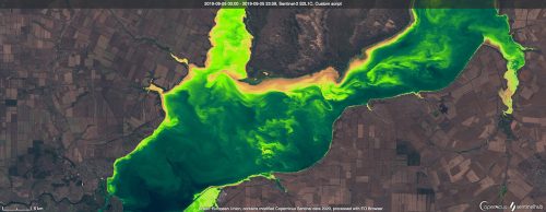
Tsimlyansk Reservoir, Russia. The Ulyssys Water Quality Viewer applied to the Sentinel-2 image, acquired on Sept 5th, 2019. The script is dynamically visualizing the chlorophyll and sediment conditions of water bodies on both Sentinel-2 and Sentinel-3 images See it in EO Browser.
Google Launches AI-powered Tree Canopy Lab
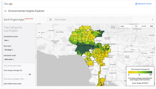
Trees are great treasures for cities. However, tracking urban vegetation is a difficult task for local authorities. It consumes large amounts of time and money. As a solution, Google’s new project, the Tree Canopy Lab, allows users to analyze tree coverage using satellite imagery that was acquired in Google Maps and Google Earth before. Moreover, the product provides map overlays of heat risk, population density and neighborhood boundaries using external public data. Note that this tool is now available for Los Angeles city.
Tree Canopy Lab creates a vegetation probability model using a tree-detection Artificial Intelligence. Read more HERE

Lidar on the iPhone 12 Pro: What it can do now, and why it matters for the future
Lidar, a brand-new technology to the iPhone 12 family, is going to be a term that many people will start hearing a lot now.
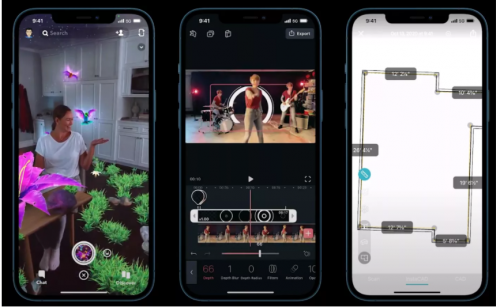
A small black circle near the camera lenses in iPhone 12 Pro models or the 2020 iPad Pro works as a lidar sensor. So many people want to know what lidar means, how it works to sense depth and how this small sensor can improve the iPhone camera’s functionality. Read more HERE

3D Laser Scan Reveals Christ The Redeemer as You’ve Never Seen It Before
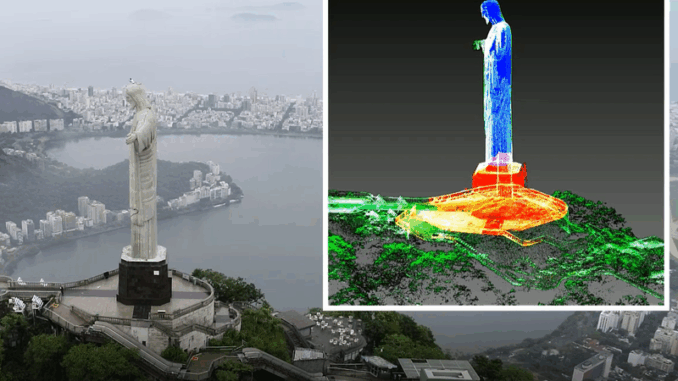
GeoSLAM, a Geospatial mapping specialist, utilized SLAM (simultaneous localization and mapping) and UAV technology to create a complete digital model of Chris the Redeemer, a historic statue located in the city of Rio de Janeiro. A series of 3D scans produced this model which shows the inside and outside of this famous monument.
Given the level of detail on this monument – from the face, hands and robe, to the staircases inside and carved marble base beneath it, I’m in awe of the capabilities of this technology and the clarity of data produced. This 3D model may become a piece of history as the statue will soon undergo renovations.
Gabriel de Barros Praxedes, GeoSLAM’s Latin America Channel Manager
Read more HERE
5,500 public sector organizations will gain access to local data
COVID-19 pandemic shows the importance of accessible geospatial data globally. According to Chris Chambers, Head of the Public Sector Geospatial Agreement at Ordnance Survey (the national mapping agency for Great Britain), location data helps public sectors respond to COVID-19 properly.
APIs are used in the Ordnance Survey Data Hub to provide a platform that public sector organizations can access accurate geospatial data easily and quickly. APIs help users save more time and focus on the decision-making process, public sector services and more creative ideas.
Better location data and improved access is crucial to boost UK economic recovery and growth.
Jamie Clark, The Geospatial Commission’s Deputy Director
Read more HERE


Be the first to comment