
- WHO Launches New Geodatabase to Strengthen Health Mapping in Africa
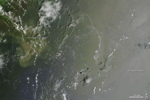
- AI and Satellite Fusion Boost Accuracy of Oil Spill Detection
- New AI Model Tracks Global Building Density and Height Every Quarter
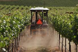
- Italy Tests Virtual Vineyards to Advance Self-Driving Tractor Technology
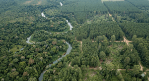
- AI Model Maps Natural Forests to Support Deforestation-Free Supply Chains
- Utilities Turn to Satellites and AI to Prevent Outages Before They Happen
WHO Launches New Geodatabase to Strengthen Health Mapping in Africa
AI and Satellite Fusion Boost Accuracy of Oil Spill Detection
Researchers at James Cook University have developed an AI model that combines synthetic aperture radar and hyperspectral imagery to map oil spills with far greater precision. By merging the strengths of both sensors, the system can distinguish oil thickness and type more reliably than traditional single-sensor approaches.
The team proposes a rapid response workflow using SAR for broad detection and the fused model for detailed characterization inside affected zones. This approach could significantly improve spill monitoring and has potential applications in tracking water quality, forest health and other environmental conditions.
New AI Model Tracks Global Building Density and Height Every Quarter
Planet and Microsoft researchers have introduced TEMPO, an AI system that estimates building height and density worldwide using quarterly PlanetScope imagery. Unlike traditional static building maps, TEMPO produces time-varying data, offering a clearer picture of how cities expand and how exposure to climate and disaster risks evolves over time.
The project includes open global layers for 2023 Q4, quarterly time series for high-growth regions, an interactive viewer, and open-source code. With strong validation scores and the ability to detect subtle quarterly changes, TEMPO supports large-scale monitoring of urban development and resilience planning.
Italy Tests Virtual Vineyards to Advance Self-Driving Tractor Technology
Researchers at the Politecnico di Milano have created high-fidelity digital vineyard environments to safely test and refine autonomous tractor systems. The simulations reproduce slopes, soil conditions and row layouts, allowing algorithms, GNSS and inertial sensors to be evaluated without the risks or costs of field trials.
The project, developed in partnership with Soluzioni Ingegneria, aims to accelerate precision agriculture by improving navigation, turning maneuvers and operator training through realistic virtual testing.
AI Model Maps Natural Forests to Support Deforestation-Free Supply Chains
Google DeepMind and partners have released Natural Forests of the World 2020, a global 10-meter map that separates natural forests from plantations and other tree cover. Using a year’s worth of Sentinel-2 imagery and topographic data, the AI model identifies the distinct patterns of intact, biodiversity-rich forests, an essential baseline for enforcing new regulations such as the EU’s deforestation-free product rules.
With 92% accuracy and global consistency, the dataset gives governments, companies, and conservation groups a trusted reference for monitoring forest protection. The team is also developing multi-year forest-type maps and releasing large open benchmark datasets to support next-generation forest modeling and transparency in global supply chains.
Utilities Turn to Satellites and AI to Prevent Outages Before They Happen
Energy companies are increasingly using high-resolution satellite imagery and AI-powered geospatial analytics to monitor infrastructure such as power lines, pipelines and vegetation. These tools detect early signs of encroachment, risky tree growth, soil changes and even methane leaks, often within hours, allowing utilities to intervene before outages, wildfires or safety hazards occur.
By replacing slow and costly ground inspections with continuous space-based monitoring, utilities gain granular insights into thousands of square miles of assets, including remote or inaccessible locations. The approach has already helped companies reduce incident rates, prioritize vegetation management and spot construction risks long before they escalate.


Be the first to comment