- DLR develops mobile station for Satellite Laser Ranging
- Fathom and World Bank collaborate to enhance flood resilience
- Black communities are using mapping to document and restore a sense of place
- Eye in the sky: GIS mapping to help curb property tax evasion
- Are Geo-Based Map Services the Future of Local Tourism?
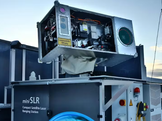
DLR develops mobile station for Satellite Laser Ranging

The German Aerospace Centre (DLR) Institute of Technical Physics unveiled a miniature Satellite Laser Ranging System (SLR). The miniature system is portable, weighing 600 kg and 1.8 m x 1.3 m x 2 m in size. Satellite Laser Ranging can measure the distance to satellites within a few mm, making it it important for getting precise locations of satellites. This can then tell us about the earth’s structure and rotation. Typically Satellite Laser Ranging is done by a team of scientist in a large complex building. The “miniSLR” is completely automatic and portable, expanding the possibility to more deployments and more observations. Read the full article here.
Fathom and World Bank collaborate to enhance flood resilience
Fathom and World Bank have come to a collaborative agreement to allow 16 countries (Burkina Faso, Burundi, Central African Republic, Chad, Democratic Republic of Congo, Djibouti, Honduras, Madagascar, Federal State of Micronesia, Mozambique, Pakistan, Papua New Guinea, Somalia, South Sudan, Timor-Leste, and Republic of Yemen) free non-commercial use of their flood risk data. The agreement includes access to both inland and costal flood risk for current years as well as several future prediction models.
Read the full article here.
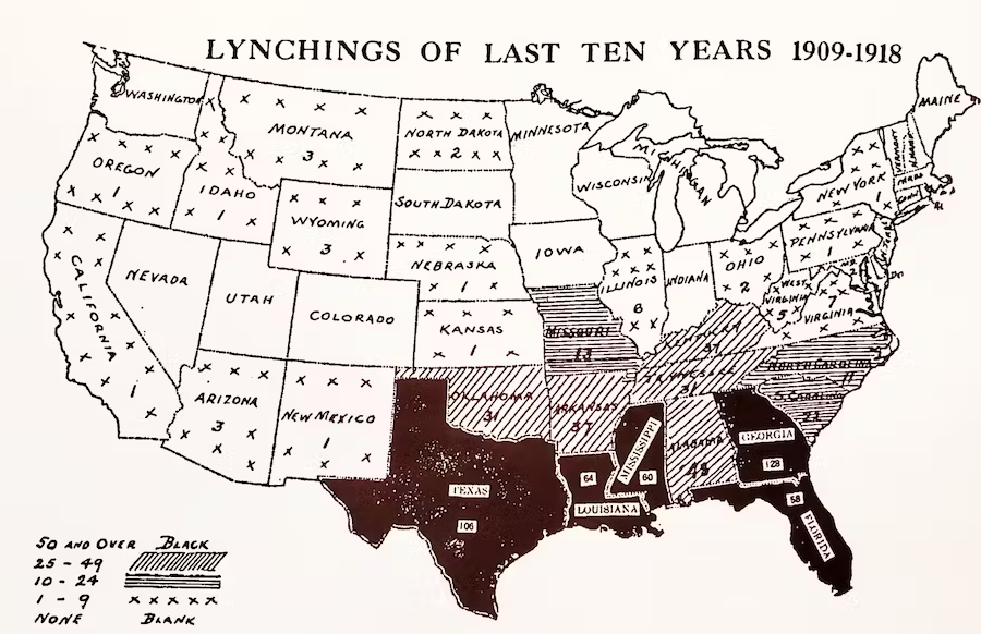
Black communities are using mapping to document and restore a sense of place
Today there is an ongoing initiative to highlight the neglected history of black mapmaking in America. Black Americans have a long history of creating maps/document their stories, however many of these have been ignored in main stream history. Many communities now are using “restorative mapping” to tell these stories.

Read the full article here.
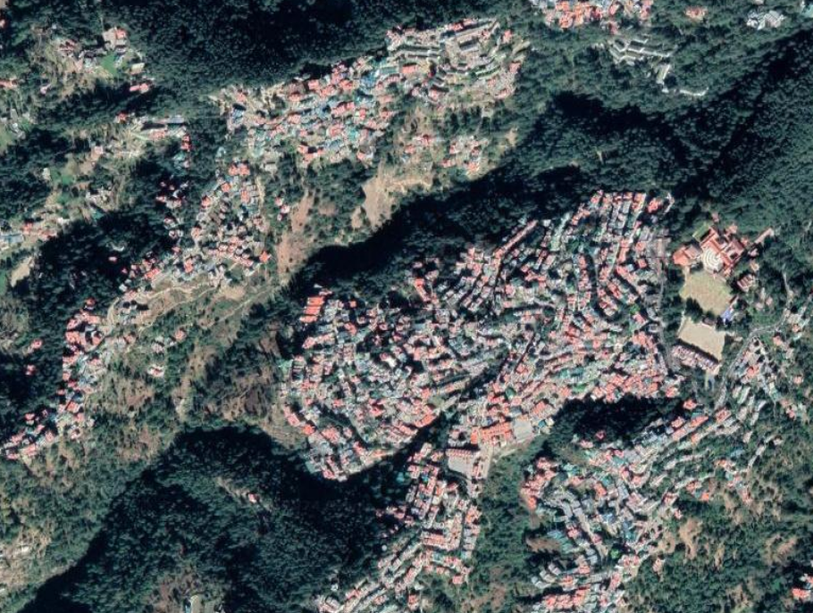
Eye in the sky: GIS mapping to help curb property tax evasion
The Shimla Municipal Corporation (SMC) has utilized aerial imagery as well as GIS in an attempt to crack down on property tax evaders. With over 30,000 homes in the municipalities conventional means of inspection would be time consuming an difficult. 3 cm resolution aerial images collected by a drone were inspected in GIS. The aim was to identify which dwellings had been modified and not updated in the central database. Further the municipality hoped to identify illegal dwellings that had been constructed. The process is done by region to region with in the city.

Read the full article here.
Are Geo-Based Map Services the Future of Local Tourism?
For many years GIS has helped people navigate from place to place, Google maps being a main source. Location base information is displayed in Google Maps, like restaurants and hotels, which make it extremely convenient for users in the area to access local services. Further innovations have allowed for hours of operation, reviews, as well as friend recommendations to all appear. For tourist these advancements have allowed for ease of travel and ensuring quality restaurants, activities, hotels, etc. are chosen. However this does pose challenges as regulations are lagging and it is these advancements are not always true and should be taken with a grain of salt.
Read the full article here.


Be the first to comment