
- NASA Satellites Show Antarctica Gained Ice. How is that Possible?
- Map Shows 80% of Peatlands Dry and Degraded
- Tulsi Gabbard Signals Shift in U.S. Intelligence Collection Priorities
- NASA Scientists Reveal how Rrees can Predict Volcanic Eruptions from Space
- Vital Role of Undersea Cable Infrastructure and Importance of Geospatial Standards
- Satellite Firms Brace for Potential Imagery Budget cuts in 2026 in U.S.
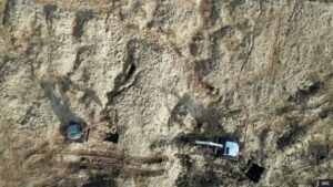
NASA Satellites Show Antarctica Gained Ice. How is that Possible?
Between 2021 and 2023, Antarctica temporarily gained ice due to unusual increases in snowfall, as shown by NASA satellite data. However, this short-term gain doesn’t reverse the long-term trend of ice loss driven by climate change. From 2002 to 2020, the continent lost massive amounts of ice, and glaciers are still flowing into a warming ocean. Scientists say the recent gain is a weather anomaly, not a sign that global warming is ending. Read more here.

Map Shows 80% of Peatlands Dry and Degraded
A new map released by the UK government shows that 80% of England’s peatlands are dry and degraded, significantly reducing their ability to store carbon and worsening climate change. Created using satellite imagery, AI, and field data, the map highlights areas like Dartmoor and the Lake District where restoration is urgently needed. With only 1% of Dartmoor’s deep peat still healthy, conservation efforts are underway, but experts warn climate change could complicate recovery. The data aims to guide targeted restoration and boost nature recovery across the country. Read more on BBC.
Tulsi Gabbard Signals Shift in U.S. Intelligence Collection Priorities
At GEOINT 2025, Director of National Intelligence Tulsi Gabbard announced what she called the biggest shift in Office of the Director of National Intelligence (ODNI) collection priorities in history. Speaking on May 19, Gabbard explained that the Trump administration’s national security strategy will reshape the work of all 18 U.S. intelligence agencies, putting unprecedented emphasis on border surveillance and counternarcotics operations, while still maintaining global intelligence efforts. She called for greater coordination across federal, state, and local agencies, breaking down information silos. Gabbard also stressed the need to modernize intelligence through AI, open-source intelligence (OSINT), and better use of commercial technologies, while streamlining contracts to cut waste. Read more here.
NASA Scientists Reveal how Rrees can Predict Volcanic Eruptions from Space
NASA scientists have developed a novel method to predict volcanic eruptions by monitoring tree health from space. Using satellite data and the AVUELO project, researchers observed that trees near volcanoes absorb volcanic carbon dioxide (CO₂), leading to greener foliage. This change in vegetation health serves as an early indicator of volcanic activity. By analyzing these patterns, scientists aim to enhance early warning systems, particularly in remote areas where traditional monitoring is challenging . Read more here.
Role of Undersea Cable Infrastructure and Importance of Geospatial Standards
The Open Geospatial Consortium (OGC) highlights the critical importance of undersea cables, which serve as the invisible backbone of the global internet, carrying nearly 99% of intercontinental data including communications, financial transactions, and military operations. To protect this vital infrastructure, OGC stresses the need for robust geospatial standards. By partnering with organizations like the International Hydrographic Organization (IHO) and the International Cable Protection Committee (ICPC), OGC is working to establish open, consensus-based standards that improve data interoperability, monitoring, and collaboration across sectors. Read more here.

Satellite Firms Brace for Potential Imagery Budget Cuts in 2026 in U.S.
The National Reconnaissance Office (NRO) has warned commercial satellite imagery providers that their funding could be cut by up to one-third from the projected $450 million budget in 2026. This would directly impact firms under the Electro-Optical Commercial Layer (EOCL) program. Industry leaders are concerned that these cuts contradict federal commitments to use commercial capabilities, especially as geopolitical threats grow. Read more here.


Be the first to comment