- Singapore’s plans to enhance geospatial capabilities and create geospatial educational programs
- Climate vulnerability index mapped by counties in the US
- Bridging the gap between Geospatial Technology and Policy
- A case study of using GIS for a large European development
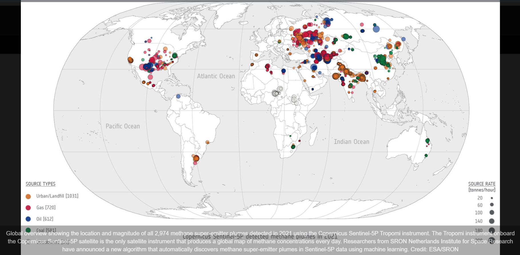
- Methane super emitters map by Sentinel satellites
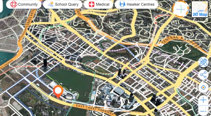
Singapore’s plans to enhance geospatial capabilities and create geospatial educational programs
At the Singapore Geospatial Festival 2023, the Singapore Land Authority (SLA), Singapore’s Geospatial Agency show case engagement plans. Such plans include challenges that uses AI to further develop the national data-driven map. Another focus was to bring geospatial technologies to the layman and create awareness in society, plans were also unveiled around educational programs that target adult learners and mid-career workers. In addition, the SLA recognized that usage of geospatial technologies can be extended beyond the professionals and aim to enhance the use of such technologies in the education of social studies and history. Read More
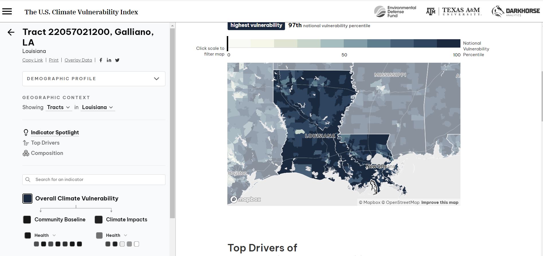
Climate vulnerability index mapped by counties in the US
A new interactive map aiming to bring awareness to the danager the climent brings to US counties has been realsed by the Environmental Defense Fund and Texas A&M University. The map reflects environmental risks by heat, wildfire smoke and drought with other social economic indexes such as income levels, access to health care and transportation. Tools like this will help planners and government agencies better allocate their resources. Read more and check out the map.
Bridging the gap between Geospatial Technology and Policy
As Geospatial technologies such as drones, remote sensing technologies, high resolution satellites, GNSS, AI and ML techniques have become more widespread in recent times, this article looks at some main considerations policy makers anaylze before adopting or regulating such technologies. Some of these are the societal impacts of Geospatial technologies, the impact of policy and regulation on science and technology and inspiring evidence-based policy development and ethical technology use. A case study that the article highlights is the EU’s Digital Strategy. Read More.

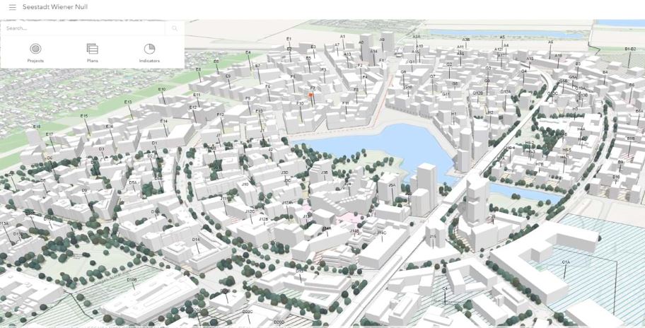
A case study of using GIS for a large European development
Aspern Seestadt, Vienna, Austria an old airfield has harnessed the use of GIS and digital twins to achieve sustainability and livability while maintaining, the classical urban structure of old Vienna. GIS has provided the visual integration tool for all project related data which infrastructure drawings and building information models are based on. In addition, the adoption of a digital twin using ArcGIS Urban, provides a visual record for all decision making. Read More.
Methane super emitters mapped by Sentinel satellites
Through a combination of Copernicus Sentinel-5P, Sentinel-2 and Sentinel-3 satellites, scientists have adopted a new way to monitor methane. Firstly, Sentinel-5P detects methane leaks anywhere on earth with a coarse resolution, next Sentinel-2 with a higher resolution hones in on the leak’s precise location. This is then monitored long term by Sentinel-3. Read More


Be the first to comment