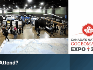
• facebook
  • Twitter
  • Linkedin
  • Youtube
  • Linkedin Group
  • Post a Job
  • Post an Ad
  • Post an Event
  • Post a Directory Listing
  • Post a Press Release
  • Media Kit
  • My Account
  • Shopping Cart
  • Login
GoGeomatics
  • MAGAZINE
    • BIM & GIS
    • Community
    • Conference news
    • Earth Observation
    • Education & Careers
    • GEOAI
    • Announcements
    • Reality Capture & Lidar
    • Science
    • Technology
    • Between the Poles
  • Directories
    • ASSOCIATION
    • INDUSTRY
    • EDUCATION
    • Open Data
  • EVENTS
    • GeoIgnite Events
    • Events Calendar
    • GoGeomatics Meetups
  • Services
    • Advertising
    • Marketing
    • Post a Job
    • Post an Ad
    • Post an Event
    • Post a Press Release
    • Post a Directory Listing
    • Media Kit
    • Web Design
  • Find a Job
  • Volunteer
    • Start a GoGeomatics Group
    • Editors & Writers Group
  • About Us
    • About Us
    • Contact Us
    • Frequently Asked Questions
  • Videos
HomeBIM & GIS

BIM & GIS

BIM & GIS

3D Mapping Transforms Smoke Monitoring

22 October 2025 Alefiya Dungrawala | 2D mapping

Wildfires across North America are no longer confined to a single season. Each year, they burn longer, spread faster, and shatter new records. Satellites have helped scientists track their movement and map the destruction in […]

Why attend?
BIM & GIS

10 Reasons to Attend and Support GoGeomatis Expo in Calgary

20 October 2025 GoGeomatics Canada | AI

The GoGeomatics Expo in Calgary, happening November 3-5, 2025 isn’t just another industry event — it’s a national gathering that connects technology, policy, and community in ways no other event does. Here are 10 reasons to […]

Digest oct 20
BIM & GIS

International Geospatial Digest – October 20, 2025

20 October 2025 Volunteer Editors and Group Writers | AI

Visualizing the Gaza conflict through maps and satellite imagery Charting global ecosystems to drive meaningful action Combining lidar and sonar to transform seafloor mapping Meet Owl: Planet’s most sophisticated satellite mission to date Topcon asserts […]

BIM & GIS

Canada-wide Flood Protection Inventory: Natural Resources Canada is seeking interested bidders

10 October 2025 GoGeomatics Canada | Canada-wide Flood Defense Inventory

As Canada grapples with the rising costs and growing frequency of climate-driven disasters, the federal government has taken a decisive step to strengthen national flood resilience. A newly announced Request for Proposals (RFP) under the […]

BIM & GIS

Canada’s Climate Progress Flatlines: Emissions Stagnate in 2024

9 October 2025 Alefiya Dungrawala | 440 mega tonnes

Reaching net-zero emissions means that Canada’s economy either produces no greenhouse gases or offsets any emissions through actions such as planting trees or using carbon capture technologies. Achieving net-zero is essential to ensure a safe […]

Tracey Lauriault
BIM & GIS

“Before It’s Too Late”: Tracey Lauriault on Canada’s Data Sovereignty Crisis

9 October 2025 Anusuya Datta | Artificial Intelligence

Digital sovereignty has quickly become one of the most pressing policy issues in Canada. From the U.S. Patriot Act and Cloud Act to the risks of foreign ownership of critical infrastructure, Canada finds itself increasingly […]

Canada Geospatial Strategy
BIM & GIS

Canada Has an AI Strategy. Why Not a Geospatial One?

8 October 2025 Anusuya Datta | Arctic

Canada has shown it can move fast when it decides something matters. Artificial intelligence is the proof. The Pan-Canadian AI Strategy, launched in 2017, was the world’s first funded national AI strategy. It built a […]

DCG Janeale
BIM & GIS

“Precision Doesn’t Have to Be Complicated or Expensive”: DCG’s Janeale Dean on Bringing Tersus Expertise to Canada

7 October 2025 GoGeomatics Canada | Autonomous systems

As Canada embarks on one of its most ambitious infrastructure build-outs in decades, Desert Creative Group (DCG), a Twin Falls, Idaho–based geospatial technology and strategy firm, is expanding north to bring advanced positioning tools to […]

Posts pagination

« 1 … 4 5 6 … 20 »

Events

Notice
There are no upcoming events.

View All Events

Services

  • Post a Job
  • Post an Ad
  • Post an Event
  • Post a Directory Listing
  • Post a Press Release
  • Media Kit
  • My Account
  • Shopping Cart
  • Login

Jobs

Post a Job
  • GIS SYSTEMS SPECIALIST
    Yellowknife, NT
  • Cartographic Analytical Technician / Technicien, analyses cartographiques; technicienne, analyses cartographiques
    Peterborough
  • Survey Technicians (Field and Office)
    Calgary, Alberta
  • Volunteer Editorial Contributor – Be Part of Canada’s Geomatics Story
    Remote
View All Jobs
  • Directories
    • Associations Directory
    • Industry Directory
    • Education Programs
    • Open Data
  • Volunteer
    • Start a GoGeomatics Group
    • Editors & Writers Group
  • About Us
    • GoGeomatics Media Kit
    • Who We Are
    • Contact Us
    • FAQ’s
    • Advertising
    • Marketing
  • Subscribe
GoGeomatics
GoGeomatics is the largest and most popular communications hub promoting the Canadian geospatial community. The business was incorporated in 2011. GoGeomatics hosts over 100 fun, free, location technology networking events each year in cities across Canada.

© 2026 GoGeomatics

  • facebook
  • Twitter
  • Linkedin
  • Youtube
  • Linkedin Group