Earth Observation
True North, Magnetic North: Tracking Earth’s Wandering Pole
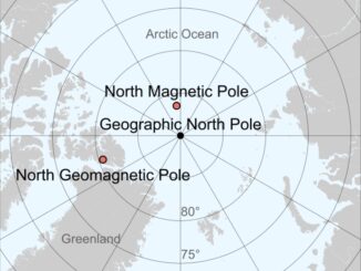
From the GPS in your phone to the navigation systems guiding aircraft and ships, our modern world depends on knowing exactly where “north” is. But here’s the twist — there isn’t just one north. There […]