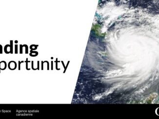
• facebook
  • Twitter
  • Linkedin
  • Youtube
  • Linkedin Group
  • Post a Job
  • Post an Ad
  • Post an Event
  • Post a Directory Listing
  • Post a Press Release
  • Media Kit
  • My Account
  • Login
GoGeomatics
  • MAGAZINE
    • BIM & GIS
    • Community
    • Conference news
    • Earth Observation
    • Education & Careers
    • GEOAI
    • Announcements
    • Reality Capture & Lidar
    • Science
    • Technology
  • Directories
    • ASSOCIATION
    • INDUSTRY
    • EDUCATION
    • Open Data
  • EVENTS
    • GeoIgnite Events
    • Events Calendar
    • GoGeomatics Meetups
  • Services
    • Advertising
    • Marketing
    • Post a Job
    • Post an Ad
    • Post an Event
    • Post a Press Release
    • Post a Directory Listing
    • Media Kit
    • Web Design
  • Find a Job
  • Volunteer
    • Start a GoGeomatics Group
    • Editors & Writers Group
  • About Us
    • About Us
    • Contact Us
    • Frequently Asked Questions
  • Videos
HomeGEOAI

GEOAI

Earth Observation

Shifting Zones: The Evolution of Canada’s Plant Hardiness System

22 July 2025 Alefiya Dungrawala | Canadian Forest Services

Over hundreds of thousands of years, the Earth — along with its climate, topography, and terrain — has undergone profound transformations driven by both natural forces and, more recently, human activities. Long-standing climatic conditions in […]

Earth Observation

Canada Invests $11.7M in National Wildfire Centre of Excellence to Boost Innovation & Resilience

20 July 2025 GoGeomatics Canada | Canada

With wildfires impacting Canadians across the country, the federal government is taking action to prevent wildfires, mitigate their effects and boost resilience. The Government of Canada’s first priority is protecting Canadians and supporting those affected […]

GEOAI

Federal Government, NWT Launch AI Core Scanning Pilot for Critical Minerals

20 July 2025 GoGeomatics Canada | AI

The Government of Canada and the Government of the Northwest Territories are working together to advance a new geoscience research initiative that leverages artificial intelligence (AI), digital scanning technologies and historic drill cores to unlock […]

Earth Observation

DND Seeks Public Input on Southern Ontario Sites for Arctic Over‑the‑Horizon Radar Program

20 July 2025 GoGeomatics Canada | A-OTHR

The Department of National Defence (DND) is seeking public feedback on the Arctic Over-the-Horizon Radar (A-OTHR) program in southern, Ontario, part of a key NORAD modernization initiative. As part of an announcement published last week, the DND stated that it aims […]

Mapex
GEOAI

Azure Clouds Rebrands as Mapex AI with Global Vision

20 July 2025 GoGeomatics Canada | AI-Powered Mapping

Mapex AI, a next-generation geospatial intelligence company, has officially launched global operations with the opening of its new client servicing office in Toronto, Canada. Formerly known as Azure Cloud Services and founded in India, Mapex […]

Hexagon Erdas
BIM & GIS

When Every Minute Counts: How Hexagon Tools Speed Up Geospatial Decisions

17 July 2025 Bruce Chaplin | agriculture

Farmers need to know which fields need water today, not next week. When satellite images sit unprocessed, crops suffer, and decisions get delayed. City planners stare at screens filled with infrastructure data, knowing somewhere in […]

GEOAI

Canada Eyes Sovereign Underwater Surveillance with AI-Driven Acoustic Tech

12 July 2025 GoGeomatics Canada | Arctic Sovereignty

The Department of National Defense is seeking efficient passive Detection, Classification, Localization, and Tracking (DCLT) algorithms to acoustically track vessels of interest using Defense Research and Development Canada’s acoustic sensors subject to different environmental conditions. […]

June 30 Digest
BIM & GIS

International Geospatial Digest June 30, 2025

30 June 2025 Volunteer Editors and Group Writers | AI

Saving Dying Reefs with Earth Engine and AI Bureaucratic Issues Facing a Joint European Space Conglomerate ESA Biomass Satellite returning long-awaited images NASA Sensor Identifying Polluted Run-off on California Coast Redrawing the Global Tea Map […]

Posts pagination

« 1 … 8 9 10 … 15 »

Events

Notice
There are no upcoming events.

View All Events

Services

  • Post a Job
  • Post an Ad
  • Post an Event
  • Post a Directory Listing
  • Post a Press Release
  • Media Kit
  • My Account
  • Login

Jobs

Post a Job
  • BIM Specialist
    Burnaby, BC
  • GIS Analyst
    Virden MB
  • GIS Analyst Student – Summer 2026
    Saint John NB
  • GIS Analyst & Developer
    Nanaimo, BC
View All Jobs
  • Directories
    • Associations Directory
    • Industry Directory
    • Education Programs
    • Open Data
  • Volunteer
    • Start a GoGeomatics Group
    • Editors & Writers Group
  • About Us
    • GoGeomatics Media Kit
    • Who We Are
    • Contact Us
    • FAQ’s
    • Advertising
    • Marketing
  • Subscribe
GoGeomatics
GoGeomatics is the largest and most popular communications hub promoting the Canadian geospatial community. The business was incorporated in 2011. GoGeomatics hosts over 100 fun, free, location technology networking events each year in cities across Canada.

© 2026 GoGeomatics

  • facebook
  • Twitter
  • Linkedin
  • Youtube
  • Linkedin Group