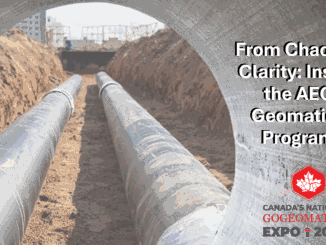
Technology
What’s New in the Version 2.3 Global Mapper Mobile Pro Module?
Designed to work with Global Mapper to take data into the field for reference and data collection, the iOS and…
Canadian Geospatial Digest for August 1, 2022
Endangered BC Heritage Site Digitally Preserved by University Professors Edelweiss Village, a heritage site in British Columbia (BC), is the…
Scribble Maps Makes Mapping Accessible to All
Wagner Demonstrates Ease of Use Among Other Strengths On March 22, 2022, during a SUMSF live stream presentation, Jonathan Wagner,…
Federal Privacy Law Bill C-27 Will Bring Potential Changes to AI Sector
Changes could be coming for AI Systems in Canada. On June 16, 2022, Bill C-27 was introduced in the House…
LiDAR COMEX Panel Discusses Lessons Learned From Challenging 3D Scanning Projects
Lessons can always be learned from challenges. LiDAR COMEX 2022 had a final panel presentation on April 5, 2022,…
Canadian BIM and Digital Twin Digest for July 28th, 2022
BIM Contracting and Infrastructure Digital Twins Businesses can improve on operating infrastructure assets by changing the way they use BIM…
Reduct NV Discusses Concept to Challenge Today’s Perspective on Gyro-Mapping
Product-as-a-service can make Gyro-Mapping more affordable for all. Otto Ballintijn, CEO of Reduct NV, introduced Product-as-a-service (Paas) as a concept…
The Federal Government of Canada Geospatial Director’s Panel at GeoIgnite 2022
During the WinterGeo summit this past March, a collection of some of the most prominent names in Canadian Geospatial sciences…
International Geospatial Briefing July 25: 1. GIS data to draw up risk assessment maps for dengue and chikungunya; 2. Europe and the U.S. Temperature Maps; 3. Europe Wildfire Maps; 4. Siemens partners with GIS software provider to level up grid planning; 5. Seattle tsunami predictive mapping
GIS data to draw up risk assessment maps for dengue and chikungunya Dr S Sabesan, an adjunct professor at the…
NavVis Changes the Game with Dynamic Mobile Mapping
During a LiDAR COMEX 2022, live stream on April 5, 2022, participants heard Marek Koltun, Senior Account Executive – Enterprise…
Canadian Geospatial Briefing July 18th: 1. Rogers Outage Map; 2. Fraser Valley Regional District Emergency Status Map; 3. With the Canadian Government as a funding partner, Ecopia AI will create 3D Map of Canada; 4. Canada’s Vegetative growth map
Rogers Outage Map Many people experienced the service outage from Rogers a few days ago. An Outage Map about…
Geosystems France Discusses Initiative to Reduce Damage to Underground Utility Networks
The DT-DICT Is Reducing Damages Patrice Lemire, Directeur General Geosystems France, was the keynote speaker for the March 22, 2022,…