Technology
From the Ground Up: Karina Delcourt discusses the relationship between reality capture and construction
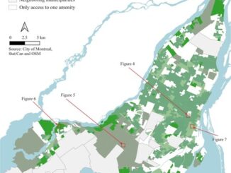
As entrenched as Karina Delcourt is in her belief in the benefits of reality capture (RC), it can’t be easy sometimes to be a tech lover in the Canadian construction industry, a market that has […]