
Proven in other industries, the utility of digitally mirrored infrastructure is gaining traction. On the surface, the lackluster and slow adoption in some sectors belies the profound and rapid progress made in other areas; you just need to know where to look.
The vision for how to, technology-wise, address the global infrastructure gap has been quite clear for many years. Progress in closing these gaps could be helped greatly by increasing engineering, construction, and operational efficiency through digitization and automation. And the form of a primary mechanism for doing this, holistically and collaboratively, has also been quite clear: 3D, spatially and data-rich digital environments. A common vision is to combine the existing and the proposed, represented and accessible via a “single pane of glass”.
Tiptoeing Around the Obvious
Have I deliberately avoided using the term “digital twins”? Yes, and not without good reason. Digital Twin is the appropriate term for these mini worlds, in how they are (or should be) created, maintained, and utilized. However, far too many folks have been jaded by how, in some instances, the concept has been oversold, the slow adoption, and the complexity and costs of creating and maintaining them. On the other hand, there are splendid examples of how infrastructure digital twins are being leveraged throughout infrastructure life cycles. Skepticism remains until people see fully fleshed-out digital twins in action. In the manufacturing sector, digital twins have been more prevalent, but in the infrastructure sector, you need to look a little deeper.
Part of the challenge in adoption for infrastructure is finding a way to describe, consistently, what constitutes an infrastructure digital twin. There are too many examples of claiming success while barely scraping the surface (no pun intended). It is not uncommon, for instance, for someone to fly a site or facility with drone imaging/lidar, create a 3D mesh model from the point cloud, and call it a “digital twin”. What processes in the various stages of infrastructure life cycles could this serve, and how was the model designed to serve potential uses? Is it really a digital twin, or simply a 3D snapshot?
Perhaps, rather than stating that something is or is not a digital twin, consider what elements it encompasses and its potential to function as such. While definitions vary, common elements (for infrastructure digital twins) would include:
- The real-world layer of the natural and built.
- Mechanisms to keep the real-world layer up to date
- Applicable attribute data from that real-world layer
- Mechanisms for connectivity, live feedback, sharing, and data automation (e.g., IoT sensors)
- Accommodation for as-designed layers and models
- Accommodation for processes to analyze and interpret the data
A dynamic, precise, and accurate digital twin can be leveraged and updated through all stages of infrastructure lifecycles: from the planning phase to design, construction, commissioning, and ongoing operations. Replication, simulation, coordination, and prediction are among the prizes a true infrastructure digital twin delivers.
Virtual design and construction, 4D construction, digital construction, BIM, constuctioneering, and other related terms populate the space where the principles, if not the entirety, of digital twin elements have been successfully applied. BIM adoption is booming in some areas of the sector. But the idea of ubiquitous adoption is still a struggle, even where various levels of detail for BIM have been made mandatory. However, 3D spatial and data-rich models in many forms, formally BIM or not, are becoming the lifeblood of those adopting digitalized construction, project management, and automation.
Enough of the evangelizing… Such things can and do exist or are nearly coming to full realization; here are some examples.
From Conceptualization to Realization
Key AEC and infrastructure solutions providers have all foreseen and moved towards a digital twin future. Siemens, Hexagon (and recent spinoff Octave), Bentley Systems, Autodesk, Topcon, etc. Hats off to Esri (that many might have associated in the past with only GIS) for its part championing the concepts of Digital Twinning, Geodesign, and 3D collaborative environments.
How far these providers (and many others) have come towards holistic digital twins that serve all aspects of infrastructure lifecycles varies quite a bit. To check every box is a tall order. Many have focused on areas where they have proven strengths and provide mechanisms to bring various elements within a digital twin ecosystem. In reality, even when full digital twins have been successfully implemented, it is rarely within one single vendor ecosystem; there’s always a need to leave the welcome mat out for seamless workflows involving 3rd party elements. And this is a key reason why some level of open source and standards continues to evolve within these otherwise proprietary ecosystems.
One prime example I’ve observed of infrastructure projects that have leveraged digital twins that are mostly within one ecosystem is Bentley Systems. While others are also nearly there, when I went down a mental checklist, they seemed to be able to fill nearly every box.
Reality, Captured
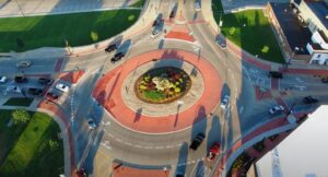
Before a project is designed, even before conceptual planning is done, existing conditions need to be considered, and design alternatives evaluated. Rich resources for geographic and geospatial data abound, and in some ways, creating a reality model is low-hanging fruit. We’re in an era where mass data capture, through lidar/imaging with drones, vehicles, backpacks, handhelds, and more, is nearly push-button. If best practices are followed, an infrastructure site can be captured in the form of many billions of 3D points.
Spatial registration of the data, if best practices are applied, and dense points can deliver incredible accuracy and precision. The ease and relatively low cost of reality capture is, ironically, a point of pain for the AEC sector. When everyone and anyone can easily and cheaply capture a tsunami of point data, this creates a logjam in downstream steps. Not the least of which is the QA/QC of the data.
Add another caveat. The advent of enhancement methods like Gaussian splatting and NeRF is all the rage for providing stunning visualizations. However, some seem to think that the better something looks, the more precise and accurate it is. Enhanced visualizations can be invaluable throughout infrastructure lifecycles, but that which catches the eye may not meet engineering needs.
Whether the existing conditions are represented in a digital twin as point clouds, 3D meshes, or occupational grids (Voxels), various automated steps (increasingly powered by AI) can clean up, classify, extract features, and even create 3D shapes of certain features (e.g., piping). Whatever form it takes, this rich fabric is like a plasma for these mini worlds.
In the Bentley Systems ecosystem, there is iTwin Capture, which had previously been called Context Capture but was renamed when certain pathways for their iTwin platform were added. This adding of iTwin elements has been ongoing throughout their portfolio. Still a ways to go, but a solid start. In context Capture, the reality capture data is processed into the spatial plasma, be it points or mesh, where it can serve as a foundation for attaching attribute data, then overlaying other contextual data and inserting design elements with downstream applications.
Draft
A respected reality capture guru I spoke with recently wondered if we could move on past CAD. He wondered if the whole paradigm of capturing something in 3D, then drafting it in 2D, then having to interpret in 3D to construct, should be over. My response was yes and no. From a reality capture perspective, something like CAD might seem like an anachronism, as many still associate it with only 2D drawings and printed plan sets. Legacy approaches to using CAD might still exist for some, but CAD has grown up. It has evolved along with digital design and construction and can be just as easily leveraged for 3D as 2D. Sure, there are still folks who insist on 2D plan sets, and we’re often still in the messy world of CAD import/export, but that is not the fault of CAD. We may not be free of the tyranny of 2D just yet, but there is steady progress.
We are still a long way from the day when you could put on a neural sensor headset, dream up some infrastructure, task AI to design it all, and have 3D printers and constructo-bots build it while you sip a cold drink on a beach. Whether you are creating a BIM or other 3D design model, there is still a lot of drafting going on. Rules-based and AI-assisted applications can assist, but there is still a need to “draft” certain elements. Bentley’s MicroStation is still, at its roots, a CAD package, and that’s what folks do with it, as the acronym CAD implies: draft (and design) with the aid of computers. Even this CAD package, staple for many in the infrastructure sector, has evolved. Bentley has incorporated accommodations for seamless data connections with downstream design packages and the iTwin environment.
Model
Creation of the 3D model of the engineering design, which can be updated throughout the construction phase, then integrated as the as-built infrastructure (geometry and data) for ongoing operations, can be a many-to-one proposition. Multiple design software packages and design teams will have a hand in creating the model. The goal may be to create a BIM model, compliant with, for example, standards like ISO 19560, IFC, NBIMS-US, COBie, or others.
An immediate imperative is to further accommodate collaborative design and construction. There was, for a time, a vision of a single big model in the cloud that everyone involved could add to, edit, and update throughout design and construction. That is not very practical given the reality of inconsistent connectivity. What often happened was that design teams would download full copies of the models, work on them, and then upload them into a nightmarish versioning maelstrom.
More practical is the idea of transactional updating, which many of the key providers have embraced. Bentley’s iModel evolved to enable this. There can be many copies of the model, but only the updates made in each are transacted via the cloud. An MEP subcontractor adds some new ducts and updates their IModel, and the IModels of other teams are synced to reflect these updates.
The idea is not completely new or unique, but Bentley has leaned into this, adding an associated open source library and bringing this in under their iTwin platform umbrella.
Design
An infrastructure project may involve multiple disciplines: roads, structures, electrical, HVAC…perhaps dozens of design teams for each area of specialization. The notion of a single design software that encompasses is, of course, completely impractical. Design teams find ways to use their favourite design software and have worked out ways to translate/export/import to incorporate with project BIM models and digital twins. Bentley has design packages for analysis and design that are evolving to integrate seamlessly with iModels (where applicable) and their iTwin environment. In many, there is some degree of open source accessibility.
Some examples (where the title is fairly self-explanatory) include OpenRoads Designer (from the legacy InRoads), ProStructures, OpenRail, OpenBridge Modeler, OpenBridge Designer, OpenPlant Modeler, and many more… you see the pattern. Again, the iTwin and open source elements are there, or may soon be.
Discipline-specific analysis software includes AutoPipe, AutoPipe Vessel, for geotechnical, OpenGround, Leapfrog, Seequent, etc. For structural, there is STAAD, Structural Worksheet, RAM Elements, etc. Lighting analysis and simulation, foot and vehicle traffic analysis, and many more.
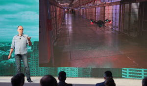
For construction coordination, tracking, difference detection, progress tracking, and more, there are packages like SYNCHRO. For the ongoing operations phase, to include monitoring, performance metrics, and prediction, there are more specific packages. I’m particularly pleased to see movement forward in monitoring, from legacy (often still analog) sensors to more plug-n-play, IoT sensors and systems, like that used in this project.
I won’t belabor the point; there’s a lot of different software for different disciplines and all phases of infrastructure lifecycles. You can look up the extensive catalogue. These packages can be used collaboratively, support some elements of open source, and are steadily being fitted into the ITwin ecosystem.
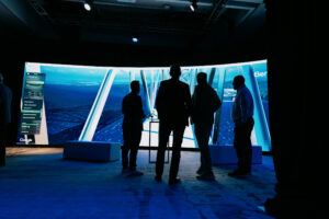
Immersive Collaboration
The concept is not new, and there have been many compelling examples from various providers over the past two decades, where multiple parties can immerse themselves in a high-fidelity, visually rich, collaborative environment to analyze, design, construct, and operate. And to do so with the experiential ease of, say, the immersive online games they are used to. Early examples were conceptually sound, but struggled before advances in processing, the cloud, high-speed/volume connectivity, and more. But an encouraging preview of the then-future that is now.
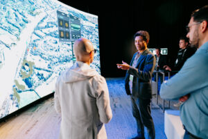
We often see examples of reality capture and design elements presented with the aid of gaming engines. It’s often quite impressive and inspiring, but sometimes cobbled together and not formally part of a well-designed, digital twin ecosystem.
A recent example of a significant development moving towards the realization of what digital twins could bring for infrastructure was the acquisition of Cesium by Bentley Systems in 2024. While not completely alone in demonstrating the power of approaches like geospatial 3D tiling, what it can do, at scale for geospatial applications, is impressive. Cesium has been particularly successful at this.
Cesium has featured in several Bentley-related projects over the past few years. For instance, the iTwin platform began supporting importing 3D tiles from Cesium in 2020. Plus, both firms have been strong supporters and advocates for open formats (where practical). I have not been alone in hoping that such collaborations would become more formal, in that combining expertise would be a great thing to help close infrastructure gaps. Now, they’ve made it official. I’d like to see more geospatial solutions providers lean in a bit more towards such collaborations.
Shortly after the acquisition of Cesium, I asked Partick Cozzi, founder and former CEO of Cesium, and now Chief Platform Officer for Bentley, how he envisions the integration: “Part of the reason for Cesium to join Bentley was that I was excited to combine iTwin and Cesium and to operate at the scale and the reach that Bentley has earned. We want to focus on where we can create the most value, and then we want to interoperate with solutions from other organizations, to empower our users and empower developers to build with best-in-class solutions.”
“An example of what we’ll be working on is how to get the tiles and the iModel from iTwin, and then bring that into Cesium,” said Cozzi. “I haven’t been writing code directly for many years; I have been involved in a lot of design, platform architecture, as well as the design for the open standards. But I’m looking forward to being a bit more technically involved now with Bentley than I was because we need to figure out a lot of details for this Cesium and iTwin collaboration.”
“Cesium can be embedded in all of these applications,” said Cozzi. “So, imagine a future when you look at the Bentley applications, you might start at that globe, and you can zoom into your site or potentially another site.”
And, specifically about the role of open source: “Users benefit from openness, and we’re all about supporting the user. It has become almost a requirement to be open. When you’re doing widely utilized open source and open standards, you’re leading the way. It does give you opportunities to build the best products that then interoperate with those standards.”

When
I like A.A. Milne’s quote, where Pooh says, “I always get to where I’m going by walking away from where I have been.” The impetus for writing this digital twin cheerleading article is that I often see folks in various infrastructure disciplines wince when they hear the term “digital twin”. Sure, from the perspective of a specific discipline, one might not see the long-term, holistic value of digital twins. It might seem an over-complex and costly investment when focused on a single type of deliverable. No matter what part you play in the infrastructure lifecycle, your data can become part of these mini worlds.
When I see the success of infrastructure projects embracing digital twinning, large and small, at events like the annual Year-in-Infrastructure Awards, I realize that the “when ” could be “right now”.

Be the first to comment