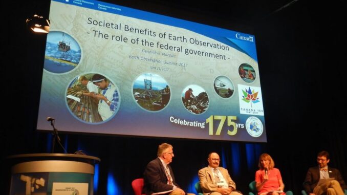
I don’t go to many conferences during the year, but the June 2017 Earth Observation (EO) Summit in Montreal is one I’m glad I attended. This was a special geomatics event that brought together practitioners, stakeholders, and students on the campus of the L’Université du Québec à Montréal (UQAM).
GoGeomatics went to cover the event and we will have a full article detailing some of the presenters and talks shortly. In the mean time I’ve put together a photo gallery of the conference and some quotes from the participants.

“One of the conference highlights was getting to see and hear about the work of the newest generation of remote sensing scientists as they undertake their graduate work. There are many current students who have a bright future in this field.” – Andrew M. Davidson PH.D, Manager, Earth Observation – Centre for AgroClimate, Geomatics and Earth Observation

“The commercialization workshop presented a great opportunity to hear and discuss different earth observation business issues, challenges of innovation and commercialization opportunities.” – Dennis Nazarenko, President, Cardinalus Consulting

“The EO Summit was a well-attended and in a great venue. It had a rich array of presentations and attendees. Moreover, the events were well organized with a Montreal touch that added to the overall experience.” – John Roos, Digital Globe Sales Director for Americas

“Combining the ASAR workshop with the CSRS was a good idea. It was great to see all the Canadian and international SAR expertise together, which led for meaningful discussions.” – Adrian McCardle, President of 3v Geomatics Inc.
Montreal 2017 EO Summit Image Gallery
The CRSS-SCT Awards
Here are the Canadian Remote Sensing Society 2017 Awards. The Award ceremonies where presented at the Banquet held in the Hall Panoramique, Centre des Sciences de Montréal during the 38th Canadian Symposium on Remote Sensing, June 20-22, 2017 in Montréal, QC.
2017 CRSS-SCT Larry Morley Gold Medal recipient is Dr. Brian Brisco of NRCan “for his significant contribution to the field of remote sensing in Canada during his whole career and for his dedication to the Canadian Remote Sensing Society.”
2017 CRSS-SCT Silver Medal recipient is Dr. Josée Lévesque of the DND-DRDC in Valcartier ”for her significant mid-career achievements in the field of remote sensing in Canada and for his dedication to the Canadian Remote Sensing Society.”
2017 CRSS-SCT Bronze Medal recipient is Dr. Alexandre Langlois from the University of Sherbrooke “For his early-career achievements as a young scientist in the field of remote sensing in Canada and for his dedication to the Canadian Remote Sensing Society”
2017 CRSS-SCT Val Shaw Memorial Award recipient is Dr. Jeff R. Harris from the Geological Survey of Canada “For his lifelong achievements in the field of remote sensing in Canada and for his dedication to the Canadian Remote Sensing Society.”
2016 CRSS-SCT Best Ph.D. Thesis Award recipient is Dr. Douglas Bolton (University of British Columbia) for his thesis entitled “Characterizing the link between fire history, productivity, and forest structure across Canada’s northern boreal using multi-source remote sensing”. (supervisor: Nicholas Coops)
2016 CRSS-SCT Best Master’s Thesis Award recipient is Mr. Curtis Chance (University of British Columbia), for his thesis entitled “Mapping the distributions of two invasive plant species in urban areas with advanced remote sensing data”. (supervisor: Nicholas Coops)
2017 CRSS-SCT Student Travel Awards recipients were Aliny Aparecida Dos Reis (Trent University), Christopher Ilori (Simon Fraser University), and Bing LU (University of Toronto Mississauga)
2016 Canadian Journal of Remote Sensing Best Paper Awards
We were delighted to announce the two CJRS best paper awards from the most recent volume year (2016):
- The first best paper award went to Alexander Trishchenko; Sylvain Leblanc; Shusen Wang; Junhua Li; Calin Ungureanu; Yi Luo; Konstantin Khlopenkov; Fabio Fontana for their paper entitled “Variations of annual minimum snow and ice extent over Canada and neighbouring landmass derived from MODIS 250m imagery for 2000-2014 period”. Canadian Journal of Remote Sensing, 42(3), 214-242.
- The second best paper award went to Joonghoon Shin; Hailemariam Temesgen; Jacob Strunk; Thomas Hilker for their paper entitled “Comparing modeling methods for predicting forest attributes using LiDAR metrics and ground measurements”. Canadian Journal of Remote Sensing 42 (6). 739-765.
Best Student Oral Presentations
1st place: Joshua Montgomery (Department of Geography, U. Lethbridge) for his oral presentation entitled “A Synthetic Aperture Radar, Optical and Lidar, Data Fusion Approach to Wetland Classification in a Boreal Environment of the Utikuma Regional Study Area, Alberta, Canada” (co-authors: Dr. Chris Hopkinson, Dr. Laura Chasmer, Dr. Brian Brisco (CCRS).
2nd place: Elise Harrington (University of Western Ontario) for her oral presentation entitled “Polarimetric radar for remote geological mapping of salt diapirs on Axel Heiberg Island, Nunavut” (co-authors: Dr. Catherine Neish, Dr. Livio Tornabene, Dr. Gordon Osinski).
3rd place: David Forsey (University of New Brunswick) for his oral presentation entitled “Mapping Eelgrass Beds in shallow coastal Waters in Tabusintac (NB) using WorldVew 2 optical Images” (co-authors: Prof. Brigitte Leblon (UNB), Dr. Marc Skinner (Stantec Ltd.), Dr. Armand LaRocque (UNB), Ms. Angela Douglas (Southern Gulf of Saint-Lawrence Coalition on Sustainability).
Best Student Poster Presentations
1st place (ex-aequo):
Jingyi Liu (Queen’s University) for her poster entitled “A Combined Method for Vegetation Classification Based on Visible Bands from Unmanned Aerial Vehicles (UAV) Images: A Case Study for Wild Parsnip Plants” (co-author: Prof. Dongmei Chen).
Claudie Ratté-Fortin (INRS-ÉTÉ) for her poster entitled “Modeling spatio-temporal variation of algal bloom using MODIS inland waters data processing” (co-authors: Prof. Karem Chokmani, Mr. Anas El Alem).
Justin Murfitt (University of Toronto Mississauga) for his poster entitled “Using RADARSAT-2 to Identify Ice Growth and Decay in Central Ontario: 2008-2016” (co-author: Dr. Laura Brown).


Be the first to comment