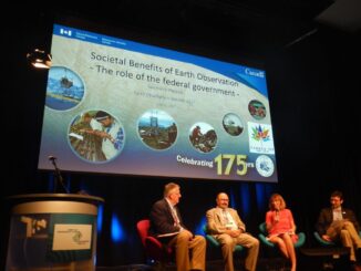
CCRS

From floppy disks to cloud computing – Exploring 35 years of Remote Sensing in the NWT

In 1987, Frobisher Bay was renamed Iqaluit, the loonie was released by the Canadian mint, and there were 13 UTM…

Montreal 2017 Earth Observation Conference Image Gallery, Quotes & Awards

I don’t go to many conferences during the year, but the June 2017 Earth Observation (EO) Summit in Montreal is…

Google Earth Engine – What is a Data Cube and Why Canadians Should Care

What is a data cube and how is it used for big data analytics?  How does a data cube work…

CANMAP, and SHIFTing gears at COGS

At the end of last month, John Wian hosted the Annual General Meeting (AGM) of the CANMAP Research Institute in…

Receiving Station Inuvik geomatics

CCRS in Ottawa: Big Geospatial Data Analytics Workshop

Almost a year ago a needs & requirement assessment was conducted to gather information on the potential development of a…

How Canadian Remote Sensing Was Made Commercially Successful & Exportable

This piece started as a note on some of my experience as an international consultant in remote sensing specifically and…

LiDAR in Canada: Conversation with Dr. Chris Hopkinson Research Chair Remote Sensing University of Lethbridge

The author Bob Maher (BM) and Chris Hopkinson (CH) both worked as scientists at the Appied Geomatics Reearch Group (AGRG)…

Ottawa CCRS Speaker Series: The Halifax air photo mission of 1921 post-WW1 air surveys in Canada

Mr. Dirk Werle, Partner / Geoscientist, Ærde Environmental Research, Halifax Date: Friday, November 13, 2015 Time: 10:30 – 12:00 Location:…

Canada Day Came Early at the Canada Aviation and Space Museum

June 23rd marked a special day in the history of aviation and space in Canada. A very special aircraft, a…

All the Geomatics Acronyms You Wanted to Know but were Too Afraid to Ask

Here in Canada, there are many geomatics acronyms that get tossed around. During the recent “Team Canada” event that the…

Product Launch – Geomatica 2014 from PCI Geomatics

GoGeomatics Canada recently attended the launch of PCI Geomatics’ latest version of Geomatica 2014, the integrated desktop image processing software.…

Lawrence W. “Larry” Morley: founder & first President of the CRSS & the first Director General of the CCRS

Very Sad News for the Remote Sensing Community. / Triste nouvelle pour la communauté de télédétection. [CRSS-SCT] Canadian Remote Sensing…