
Vaughan, Ontario, CANADA – September 14, 2021 – Teledyne announces the launch of a geospatial group with the unification of its Optech and CARIS businesses. The new Teledyne Geospatial group will offer holistic solutions to seamlessly map land and sea through the integration of industry-leading lidar sensors combined with world-renowned software workflows.
Teledyne Optech has been a world leader in the design, development and manufacture of advanced lidar instruments for more than 45 years. And for over four decades, Teledyne CARIS has developed market-dominating software for the marine GIS community.
This collaboration provides customers with a competitive edge in mapping and delivering data products inside of one complete workflow. Ease of collection and processing, through to final product, is enhanced with efficiency-driving AI algorithms and real time quality control. Ongoing collaborations with other Teledyne businesses extends the geospatial capabilities even further.
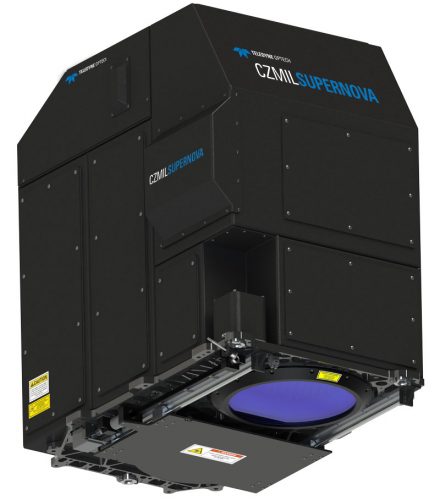
The CZMIL SuperNova, the first product from Teledyne Geospatial, integrates Optech’s bathymetric lidar with CARIS’ comprehensive processing software providing the highest performing bathymetric lidar system in the world.
Andy Hoggarth, Vice President, Sales and Marketing at Teledyne Geospatial explains: “Businesses today are increasingly expected to offer a more comprehensive suite of services. Bringing Optech and CARIS together allows us to leverage the world-leading expertise of both companies, ensuring customers can fully realize the competitive advantages provided by our ability to deliver holistic solutions for land and sea.”
Join us at Intergeo, September 21-23 in Hannover, Germany, at Hall 020 booth C16.
Teledyne Geospatial unifies the hardware and software expertise of two unique companies in the geospatial arena. The new group provides customers with innovative integrated solutions. Offerings will include turnkey systems, lidar and sonar integrated workflows and a range of systems and solutions that support holistic, precision data collection.
Notes to Editors:
For media enquiries, please contact:
Jennifer Parham


Be the first to comment