• facebook
  • Twitter
  • Linkedin
  • Youtube
  • Linkedin Group
  • Post a Job
  • Post an Ad
  • Post an Event
  • Post a Directory Listing
  • Post a Press Release
  • Media Kit
  • My Account
  • Login
GoGeomatics
  • MAGAZINE
    • BIM & GIS
    • Community
    • Conference news
    • Earth Observation
    • Education & Careers
    • GEOAI
    • Announcements
    • Reality Capture & Lidar
    • Science
    • Technology
  • Directories
    • ASSOCIATION
    • INDUSTRY
    • EDUCATION
    • Open Data
  • EVENTS
    • GeoIgnite Events
    • Events Calendar
    • GoGeomatics Meetups
  • Services
    • Advertising
    • Marketing
    • Post a Job
    • Post an Ad
    • Post an Event
    • Post a Press Release
    • Post a Directory Listing
    • Media Kit
    • Web Design
  • Find a Job
  • Volunteer
    • Start a GoGeomatics Group
    • Editors & Writers Group
  • About Us
    • About Us
    • Contact Us
    • Frequently Asked Questions
  • Videos
Home2015

2015

Technology

Marine Geomatics Primer: Using UUVs to Take Flight Underwater

20 January 2017 Elaha Akrami | 2012

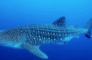
Unmanned Underwater Vehicles One of the most interesting things to happen in regards to marine geomatics technology has been the development of advanced Unmanned Underwater Vehicles (UUVs). Think of the UUV as the underwater counterpart […]

||
Technology

The Future of GIS Software? QGIS A Popular Open-Source GIS for the Masses

16 January 2017 Francis Guo | 2015

In today’s geomatics society, ArcGIS, developed by Esri, is a giant and dominates the GIS software market. However, there are some other great and powerful GIS software applications. QGIS is a typical GIS application among […]

|||
Technology

Predicting the Future of the GIS in Canada

1 December 2016 Gordon Plunkett | 2015

Editors note: This article has been jointly written by Bruce McCormack and Gordon Plunkett. Bios can be found at the bottom of the article. Most people like to predict the future. People are interested in […]

|
Education & Careers

Geospatial Development: Enhancing GIS curricula with programming skills at UNB

29 November 2016 Emmanuel Stefanakis | 2014

Geospatial information science and technology (GIS&T) has rapidly evolved over the last few decades. This evolution has created a highly demanding job market for GIS professionals [3,4]. Recently, students, graduates, and professionals are more and […]

||||||||||
Education & Careers

Easy Access to Data: The CGDI Initiative

28 November 2016 Elaha Akrami | 2013

The Canadian Geospatial Data Infrastructure (CGDI) is an initiative of Natural Resources Canada that began in 2001. The CGDI does not refer to a specific database, but rather a collection of Canadian geospatial resources available […]

Newsmakers & Press Releases

what3words adopted by six national mapping agencies

25 November 2016 GoGeomatics Newsmakers | 2013

what3words, the multi-award winning location reference system, has today announced that six national mapping agencies have adopted 3-word addresses. Used to input and share locations within national online geoportals, what3words is making it simpler for […]

Students Talking|||||||||||
Education & Careers

Ten Online GIS Programs in Canada

24 November 2016 Priscilla Ancinelli | 2015

After completing an undergraduate degree in 2015, (Geography and Environmental Studies at the University of Toronto) I needed to determine which direction to take in the next chapter of my academic and professional career. I […]

No Picture
Newsmakers & Press Releases

NB 911 Bureau Receives Esri Canada Award of Excellence in GIS

26 October 2016 GoGeomatics Newsmakers | 2012

FREDERICTON, Esri Canada User Conference – October 25, 2016 – Esri Canada today presented the NB 911 Bureau, a branch of the New Brunswick Department of Justice and Public Safety, with an Award of Excellence […]

Posts pagination

« 1 2 3 … 20 »

Events

Notice
There are no upcoming events.

View All Events

Services

  • Post a Job
  • Post an Ad
  • Post an Event
  • Post a Directory Listing
  • Post a Press Release
  • Media Kit
  • My Account
  • Login

Jobs

Post a Job
  • Canada Maps and Poster Gallery Volunteer Leads — GeoIgnite 2026
    remote
  • GIS & Data Analytics Lead
    Beaumont, AB
  • Lead Surveyor, Projects/Arpenteur-géomètre principal, projets; arpenteuse-géomètre principale, projets
    North Bay, Thunder Bay
  • Senior GIS Developer
    Calgary, AB
View All Jobs
  • Directories
    • Associations Directory
    • Industry Directory
    • Education Programs
    • Open Data
  • Volunteer
    • Start a GoGeomatics Group
    • Editors & Writers Group
  • About Us
    • GoGeomatics Media Kit
    • Who We Are
    • Contact Us
    • FAQ’s
    • Advertising
    • Marketing
  • Subscribe
GoGeomatics
GoGeomatics is the largest and most popular communications hub promoting the Canadian geospatial community. The business was incorporated in 2011. GoGeomatics hosts over 100 fun, free, location technology networking events each year in cities across Canada.

© 2025 GoGeomatics

  • facebook
  • Twitter
  • Linkedin
  • Youtube
  • Linkedin Group