Other
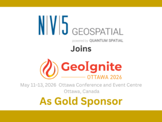
NV5 Geospatial Joins GeoIgnite 2026 as Gold Sponsor
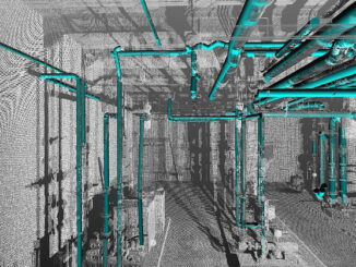
NV5 Geospatial Solutions Joins GeoIgnite 2026 as Gold Sponsor GoGeomatics Canada is pleased to announce that NV5 Geospatial Solutions will participate as a Gold Sponsor of GeoIgnite 2026, Canada’s national geospatial leadership conference. NV5’s participation […]