• facebook
  • Twitter
  • Linkedin
  • Youtube
  • Linkedin Group
  • Post a Job
  • Post an Ad
  • Post an Event
  • Post a Directory Listing
  • Post a Press Release
  • Media Kit
  • My Account
  • Login
GoGeomatics
  • MAGAZINE
    • BIM & GIS
    • Community
    • Conference news
    • Earth Observation
    • Education & Careers
    • GEOAI
    • Announcements
    • Reality Capture & Lidar
    • Science
    • Technology
  • Directories
    • ASSOCIATION
    • INDUSTRY
    • EDUCATION
    • Open Data
  • EVENTS
    • GeoIgnite Events
    • Events Calendar
    • GoGeomatics Meetups
  • Services
    • Advertising
    • Marketing
    • Post a Job
    • Post an Ad
    • Post an Event
    • Post a Press Release
    • Post a Directory Listing
    • Media Kit
    • Web Design
  • Find a Job
  • Volunteer
    • Start a GoGeomatics Group
    • Editors & Writers Group
  • About Us
    • About Us
    • Contact Us
    • Frequently Asked Questions
  • Videos
Homeapple maps

apple maps

|||
Technology

Geospatial Technology Guiding the Development of Autonomous Vehicles

11 January 2024 Jake MacLean | apple maps

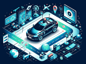
Driver-less cars, also known as autonomous vehicles or self-driving cars, are vehicles that are equipped with sensors, cameras, and other technologies that enable them to navigate and operate without the need for human input or […]

Technology

Canadian Geospatial Digest May 29th, 2023

29 May 2023 Volunteer Editors and Group Writers | air quality

Why are hazard maps still lacking in NWT communities? Alberta wildfires are depicted on a digital map in near real-time. Make use of the Esri Canada Air Quality Aware App to monitor air quality. In […]

|
Technology

Canadian Geospatial Digest for August 15, 2022

15 August 2022 GoGeomatics Canada | alberta

Apple Maps is Coming to Your City this Summer, Satellites show World’s Largest Beaver Dam, Who lives in Canada’s Hottest Urban Centres, Western University Investigates Storm Apple Maps is Driving, and Walking, Through Canadian Cities […]

|||||
Technology

Canadian Geospatial Briefing Oct. 4th: Netflix Canada map; Lim Geomatics; accurate COVID-19 mapping; BC rising sea-level maps; Apple Maps in Canada; rural open data event

4 October 2021 GoGeomatics Canada | apple canada

Netflix Canada launches website showing its filming locations across the country Netflix in Your Neighbourhood will allow users to search for filming locations by searching for a film or series title or by province and will […]

||||
Technology

Canadian Geospatial Briefing Sept 20th: Interactive Election Map; MDA awarded with contract for Martian Moons Exploration with Japan Aerospace Exploration Agency; Geomatics Instructor at BCIT uses Drone to Display Elevation Changes at Construction Site; Looking at Foot Traffic in the Downtown Core of Major Canadian Cities Compared to Pre-Pandemic Levels; Apple Maps using Special Backpacks to Gather Data for Look Around Feature

20 September 2021 GoGeomatics Canada | apple maps

Interactive: How Canadians voted in the past 7 federal elections With the federal elections coming up on September 20th, Esri Canada has created an interactive map that highlights the last seven election results going back […]

||||||
Technology

Canadian Geospatial Briefing June 21st, 2021: Apple Maps Cars; Population growth and Housing issues; Elizabeth Cannon’s honorary degree; Saskatchewan’s growing opioid deaths maps; Modernizing COMPSTAT at the Vancouver Police Dept.

21 June 2021 GoGeomatics Canada | apple maps

Here’s Where Apple Maps Cars are Collecting Images in Canada this Summer Two years ago, a fleet of Apple Maps cars started driving across Canada to improve its own maps. The image below, taken by Jesse […]

|||||
Technology

Your Canadian Geospatial Briefing for June 3rd: Mapbox; Location Tech myths; Maxar; Apple Maps; UrtheCast

3 June 2019 GoGeomatics Canada | Apple

Mapbox joins GeoIgnite 2019  GeoIgnite has a new platinum sponsor! Location data platform Mapbox is joining the top decision makers and innovators from technology, government and academia in discussing the current and future of Canada’s location […]

Events

Notice
There are no upcoming events.

View All Events

Services

  • Post a Job
  • Post an Ad
  • Post an Event
  • Post a Directory Listing
  • Post a Press Release
  • Media Kit
  • My Account
  • Login

Jobs

Post a Job
  • Canada Maps and Poster Gallery Volunteer Leads — GeoIgnite 2026
    remote
  • GIS & Data Analytics Lead
    Beaumont, AB
  • Lead Surveyor, Projects/Arpenteur-géomètre principal, projets; arpenteuse-géomètre principale, projets
    North Bay, Thunder Bay
  • Senior GIS Developer
    Calgary, AB
View All Jobs
  • Directories
    • Associations Directory
    • Industry Directory
    • Education Programs
    • Open Data
  • Volunteer
    • Start a GoGeomatics Group
    • Editors & Writers Group
  • About Us
    • GoGeomatics Media Kit
    • Who We Are
    • Contact Us
    • FAQ’s
    • Advertising
    • Marketing
  • Subscribe
GoGeomatics
GoGeomatics is the largest and most popular communications hub promoting the Canadian geospatial community. The business was incorporated in 2011. GoGeomatics hosts over 100 fun, free, location technology networking events each year in cities across Canada.

© 2025 GoGeomatics

  • facebook
  • Twitter
  • Linkedin
  • Youtube
  • Linkedin Group