ArcGIS Online
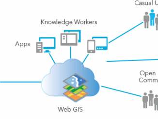
Paul Barker: What is Web GIS? Exploring the ‘new’ GIS
GIS has always been an integral part of forward thinking organizations. However, it has long struggled to break out of…
Map Tiles and Cached Map Services
The tiling of large maps is an old practice. Large paper maps have always been divided into a series…
District of Squamish Wins Esri Canada’s Award of Excellence in GIS
VANCOUVER, Esri Canada User Conference – November 17, 2015 – The District of Squamish is a fast-growing municipality between the…
Elevation Web Services: Limitations and Prospects
Elevation Web Services: Limitations and Prospects Elevation data is necessary for a wide range of geospatial applications such as creating…
Nova Scotia Power Wins Esri Special Achievement in GIS Award
Enterprise implementation of geospatial platform transforms electric utility operations San Diego, CA, Esri International User Conference – Esri Canada congratulates…
West Parry Sound Geography Network Wins Esri Canada’s Award of Excellence in GIS
Use of mapping technology facilitates efficient data sharing and increased collaboration among rural municipalities Thunder Bay, ON, Esri Canada User…
Ville de Montréal Wins Award for Innovative Snow Removal Mapping Application
Cloud-based mobile app communicates real-time snow removal information, enabling citizens to effectively plan around parking restrictions QUÉBEC, Esri Canada User…
City of Hamilton Revamps Online Engineering Records System Using Esri Technology
New SPIDER system significantly increases speed and accuracy of document searches HAMILTON – April 30, 2015 – The City of…
BC Assessment Wins Award for Transforming Property Assessment Using GIS
Geospatial solutions improve accuracy and access to property information VICTORIA, Esri Canada User Conference – April 15, 2015 – BC…
EnWin Utilities Recognized for Using GIS to Improve Access to Key Operational Information
Consolidating hydro and water network data into a single geodatabase provides better decision support London, Esri Canada User Conference –…
University of Waterloo Students Win the Esri Canada GIS Centres of Excellence App Challenge
PredictION helps citizens understand the impact of proposed transit changes to their daily commute TORONTO – Esri Canada congratulates Jonathan…
Vancouver Island University GIS Students Take on Real-World Issues with Esri’s Software Suite
Students don’t need to be located in Nanaimo, British Columbia to get a post-graduate diploma in GIS applications from Vancouver…