BIM & GIS
RCGS Unveils Canada Globe: Why It Matters Beyond Cartography
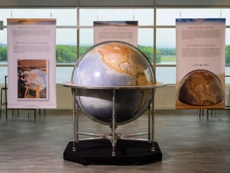
The Royal Canadian Geographical Society (RCGS) has unveiled a bold new globe at its Ottawa headquarters. The five-foot sphere, nicknamed the Canada Globe, was handcrafted by Bellerby & Co., renowned British globe makers, and gifted […]