Technology
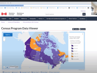
Collaboration of VertiGIS and Statistics Canada Update Census Program Data Viewer
Overcoming Challenges to Make Complex Data Accessible to All VertiGIS and Statistics Canada presented the collaborated result of the updated Canada Update Census Program (CPDV) during a GeoIgnite, Winter Geo conference livestream on March […]