Earth Observation
After Landsat 7: Honouring a Legacy, Continuing the Mission
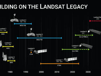
Every pixel tells a story. On June 4, 2025, Landsat 7 was officially decommissioned, closing out a mission that spanned more than two decades. Launched in 1999, Landsat 7 carried the Enhanced Thematic Mapper Plus […]