Community Engagement
Building on Canada’s Cartographic Evolution: The Canada Maps Traveling Gallery
Mapping has a rich and storied tradition in Canada, reflecting the country’s diverse landscapes and complex geographic features. Indigenous peoples…
Interview: The Crucial Role of Geospatial Data and AI in Building a National Flood Strategy for Canada
Canada has faced a surge of extreme weather events in recent years, with devastating floods impacting communities nationwide. These events…
Canadian Geospatial Digest January 15, 2024
Remote First Nation Community Getting High-Quality Digital Twin Exploring and Mapping the Environmental Stressors around Wood Buffalo National Park New…
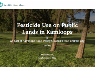
Pesticide use public presentation using ArcGIS StoryMaps and Instant Apps
The beginning of the story In the past summer, Kamloops Food Policy Council (KFPC) launched a research project to study…
OAGEE Fall 2021 Virtual Conference – Call for presenters
#Planning for the future The Ontario Association of Geographic and Environmental Education will host a virtual conference on Saturday, October…
URISA BC – Engage: Make It So With GIS in Community Engagement
What: Engage: Make It So With GIS in Community Engagement Where: Vancouver, BC When: Thursday, 15 June 2017 from 8:00…
URISA BC: Vancouver Call for Presentations on GIS Trends in Community Engagement
Call for Presentations Following the success of our December event, the URISA BC Executive Team is busy planning our next…
Making is Connecting: the social meaning of creativity
I spent Christmas in Sydney, Cape Breton. While there, I had the time to read David Gauntlett’s book ‘Making is Connecting’.…
A Tale of Two Communities
After the Atlantic Canadian Association of Geographers (CAG) workshop: Geography Education (previous blog: http://wp.me/p2586i-4xP), I have a renewed enthusiasm for…
West Parry Sound Geography Network Wins Esri Canada’s Award of Excellence in GIS
Use of mapping technology facilitates efficient data sharing and increased collaboration among rural municipalities Thunder Bay, ON, Esri Canada User…
tecconnect Making Lethbridge a Hub for Geospatial Technology
How can we foster a strong geospatial sector in our cities and communities across Canada? Economic Development Lethbridge’s (EDL) answer…
Celebrating GIS Day at Carleton University
GIS Day is November 19, and GoGeomatics is looking forward to participating in this global celebration at Carleton University’s GIS…