• facebook
  • Twitter
  • Linkedin
  • Youtube
  • Linkedin Group
  • Post a Job
  • Post an Ad
  • Post an Event
  • Post a Directory Listing
  • Post a Press Release
  • Media Kit
  • My Account
  • Login
GoGeomatics
  • MAGAZINE
    • BIM & GIS
    • Community
    • Conference news
    • Earth Observation
    • Education & Careers
    • GEOAI
    • Announcements
    • Reality Capture & Lidar
    • Science
    • Technology
  • Directories
    • ASSOCIATION
    • INDUSTRY
    • EDUCATION
    • Open Data
  • EVENTS
    • GeoIgnite Events
    • Events Calendar
    • GoGeomatics Meetups
  • Services
    • Advertising
    • Marketing
    • Post a Job
    • Post an Ad
    • Post an Event
    • Post a Press Release
    • Post a Directory Listing
    • Media Kit
    • Web Design
  • Find a Job
  • Volunteer
    • Start a GoGeomatics Group
    • Editors & Writers Group
  • About Us
    • About Us
    • Contact Us
    • Frequently Asked Questions
  • Videos
Homeconferences

conferences

|
Newsmakers & Press Releases

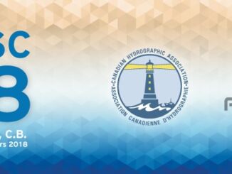
Canadian Hydrographic & National Surveyors Conferences: 2018 Victoria, BC: March 26-29

20 March 2017 GoGeomatics Newsmakers | 2018

2018 Canadian Hydrographic & National Surveyors Conferences  March 26-29, 2018, Victoria B.C. Sponsor and Exhibitor Registration is now opened.  You are invited to partner with the Canadian Hydrographic Association and the Association of Canada Lands […]

|
Newsmakers & Press Releases

Toronto & Calgary: Federal Floodplain Mapping Workshop March 28th & 30th

9 March 2017 GoGeomatics Newsmakers | 2017

The Federal Floodplain Mapping Guidelines workshop, hosted by Canadian Water Resources Association (CWRA) on behalf of the Government of Canada, has been arranged in order to present and gather input regarding the recently developed Federal […]

||
Newsmakers & Press Releases

Canadian Remote Sensing Training: Summer School – Montreal 19 June 2017

7 March 2017 GoGeomatics Newsmakers | 2017

The Earth Observation (EO) Summit 2017 brings together in one exceptional event the 38th Canadian Symposium on Remote Sensing (CSRS), the 17th Congress of the Association Québécoise de Télédétection (AQT), the 11th Advanced SAR (ASAR) […]

Technology

Software Development – The Key to Ecere’s Success

2 February 2017 Ozair Khan | 2012

It is rare to learn of a GIS company in which much R&D is done up front to create the programming language used to build its tools. Ecere, a Canadian company based in Gatineau, Québec, […]

Technology

Marine Geomatics Primer: Using UUVs to Take Flight Underwater

20 January 2017 Elaha Akrami | 2012

Unmanned Underwater Vehicles One of the most interesting things to happen in regards to marine geomatics technology has been the development of advanced Unmanned Underwater Vehicles (UUVs). Think of the UUV as the underwater counterpart […]

|
Education & Careers

How to Start Your Career in GIS

4 January 2017 Priscilla Ancinelli | advice

You are reaching the point of your life where you are finishing up your last year of college or university and your next step is finding a Geographic Information Systems (GIS) entry-level job. You are […]

Canadian flag||||||
Community

List of Canadian Geomatics Conferences and Events for 2017

20 December 2016 GoGeomatics Canada | 2017

This is our list Canadian geomatics conferences and events for 2017. Here you will find events pertaining to GIS, remote sensing, surveying, cartography, and informatics. We’re always updating this list, so if you have a […]

|A portrait of Jessi Mielke
Education & Careers

Jessi Mielke Esri’s Certification Manager Chats About the Esri Technical Certification Program

29 August 2016 Brian Bancroft | advice

For the last 6 months I’ve been writing articles and discussing my experience in regards to the Esri technical certification program.  You can see a list of my prior articles below. – Esri Technical Certification: […]

Posts pagination

« 1 2 3 4 … 10 »

Events

Notice
There are no upcoming events.

View All Events

Services

  • Post a Job
  • Post an Ad
  • Post an Event
  • Post a Directory Listing
  • Post a Press Release
  • Media Kit
  • My Account
  • Login

Jobs

Post a Job
  • Canada Maps and Poster Gallery Volunteer Leads — GeoIgnite 2026
    remote
  • GIS & Data Analytics Lead
    Beaumont, AB
  • Lead Surveyor, Projects/Arpenteur-géomètre principal, projets; arpenteuse-géomètre principale, projets
    North Bay, Thunder Bay
  • Senior GIS Developer
    Calgary, AB
View All Jobs
  • Directories
    • Associations Directory
    • Industry Directory
    • Education Programs
    • Open Data
  • Volunteer
    • Start a GoGeomatics Group
    • Editors & Writers Group
  • About Us
    • GoGeomatics Media Kit
    • Who We Are
    • Contact Us
    • FAQ’s
    • Advertising
    • Marketing
  • Subscribe
GoGeomatics
GoGeomatics is the largest and most popular communications hub promoting the Canadian geospatial community. The business was incorporated in 2011. GoGeomatics hosts over 100 fun, free, location technology networking events each year in cities across Canada.

© 2025 GoGeomatics

  • facebook
  • Twitter
  • Linkedin
  • Youtube
  • Linkedin Group