data management
SpatioTemporal Asset Catalogs: Enabling online search and discovery of geospatial assets
What is STAC? STAC stands for SpatioTemporal Asset Catalog. It is a language for geospatial catalogs and assets with a…
Panelists Discuss Using Geointelligence and AI to Solve Real World Problems
Maxar Sponsors Panel Discussion at GeoIgnite, Winter Geo During a livestream at the GeoIgnite, Winter Geo conference on March 1,…
GeoIgnite 2020: Growing Canada’s Next Earth Observation (EO) Generation
GeoIgnite is Canada’s National Geospatial conference hosted by GoGeomatics Canada. GeoIgnite was held online using Zoom July 22nd to 24th,…
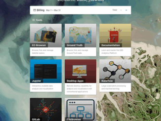
GEOAnalytics.ca – A demonstration cloud-native open platform for Big Data geoscience
Current data-driven and computing intensive research on climate-change, ecosystem modeling, and environmental and natural resources monitoring is based on the…
Let the Scientists do Science: Efficient Data Management Design for Biological Field Surveys
Defining the problem Environmental consulting is a fast-paced industry for good reason. Whether it’s the constraints of the season, the…
GIS Open Source versioning tool for a multi-user Distributed Environment (part 2)
Cet article est aussi disponible en français. This article is the 2nd part of GIS Open Source versioning tool for a multi-user Distributed…
GIS Open Source versioning tool for a multi-user Distributed Environment (part 1)
Editors note: This article has been jointly written by Nicolas Gignac, Dami Sonoiki (eHealth Africa) and Samuel Aiyeoribe (eHealth Africa). These authors…
Montreal: K2 Geospatial launches latest version map-based integration platform JMap
More powerful, even more robust and interoperable, JMap 7 is now available JMap’s 7th version is finally here! K2 Geospatial,…
Esri Canada Community Maps Program: Why more communities need to take advantage of this
The Community Maps Program (CMP) was introduced by Esri Canada in 2009 allowing organizations to share and host geographic data. …
Ten Online GIS Programs in Canada
After completing an undergraduate degree in 2015, (Geography and Environmental Studies at the University of Toronto) I needed to determine…
New Brunswick: CARIS Announces release of HIPS and SIPS™ 10
Fredericton, NB, Canada – November 01, 2016 – Teledyne CARIS™ is pleased to announce the release of HIPS and SIPS™ 10.…
NB 911 Bureau Receives Esri Canada Award of Excellence in GIS
FREDERICTON, Esri Canada User Conference – October 25, 2016 – Esri Canada today presented the NB 911 Bureau, a branch…