data management
NB 911 Bureau Receives Esri Canada Award of Excellence in GIS
FREDERICTON, Esri Canada User Conference – October 25, 2016 – Esri Canada today presented the NB 911 Bureau, a branch…
GoGeomatics Kelowna: September Success & October Social With Talk from Esri Canada
GoGeomatics Kelowna’s first Back-to-School September social was a huge success! Among the attendees were a great group from Stantec, our…
University of Victoria Hosts Advanced Spatial Analysis Course
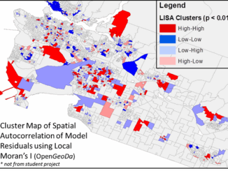
Is neighbourhood socioeconomic status associated with pediatric and childhood injuries? Are such injuries clustered in space? How can I model…
GIS Certification: Esri Certification
Many GIS Certification options exist for Canadian geomatics professionals, including software-specific certifications. One popular software certification is the Technical Certification…
Professional Certification: Population Health Data Analysis in British Columbia
Population health research is inherently interdisciplinary, multifaceted and firmly rooted in the evolving connections between place, time and related socioeconomic…
Esri Canada Named Gold Standard Winner among Canada’s Best Managed Companies
Esri Canada, the country’s leading enterprise geographic information system (GIS) solutions provider, has been named a Gold Standard winner among…
Jobs: Career Strategies for Students and Recent Graduates in GIS
What Students and Recent Graduates Can Do Relating to another article I wrote, called “Career Challenges for Students and…
Esri Canada to Open GIS Centres of Excellence at the University of New Brunswick and York University
TORONTO – February 1, 2016 – Esri Canada, the leading provider of geographic information system (GIS) solutions, has named the…
GIS: Parks Canada Receives Award for Enterprise Approach to Data Management
OTTAWA, Esri Canada User Conference – October 6, 2015 – Parks Canada fosters public understanding, appreciation and enjoyment of Canada’s…
Open Data Portals and Geomatics: The Polar Data Catalogue
The growing interest in providing open data access has long been integrated into the field of Geomatics. However, the use…
West Parry Sound Geography Network Wins Esri Canada’s Award of Excellence in GIS
Use of mapping technology facilitates efficient data sharing and increased collaboration among rural municipalities Thunder Bay, ON, Esri Canada User…
EnWin Utilities Recognized for Using GIS to Improve Access to Key Operational Information
Consolidating hydro and water network data into a single geodatabase provides better decision support London, Esri Canada User Conference –…