DigitalGlobe
MDA to Acquire DigitalGlobe, Creating Industry Leader in End-to-End Space Systems, Earth Imagery and Geospatial Solutions
San Francisco and Westminster, Colo. – MacDonald, Dettwiler and Associates Ltd., a global communications and information company providing technology solutions…
December 14th is the Ottawa CRSS GoGeomatics Christmas Party
Get your sleighbells jingling for the CRSS GoGeomatics Christmas Party! For the fourth year in a row, we’re teaming up…
DigitalGlobe’s Basemap Suite Expands: 250 Million Square Kilometers of 30 cm Imagery
DigitalGlobe, Inc. (NYSE: DGI), the global leader in Earth imagery and information about our changing planet, today announced that its…
The Importance of Students & Young Professionals in Canada’s Geomatics Community
With the help of our sponsors GoGeomatics Canada is bringing students and young geospatial professionals together at 11 events from…
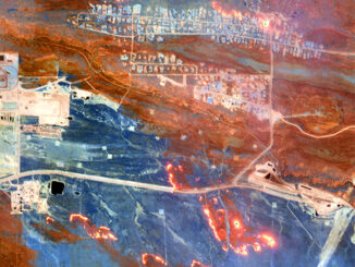
Seeing Through Wildfire Smoke in Fort McMurray, Alberta with Infrared Imaging
Images of the massive wildfire that engulfed Fort McMurray, Alberta earlier this year have been seared into our collective consciousness.…
Countdown to Launch: DigitalGlobe’s WorldView-4 Earth Imaging Satellite
Final preparations are underway at Lockheed Martin to ship DigitalGlobe’s WorldView-4 earth imaging satellite to Vandenberg Air Force Base for…
UNB & Google Maps: New EarthView3D Technology
University of New Brunswick researcher, Yun Zhang, is no stranger to Google Maps. In 2000, he participated in a Street…
MDA to provide multiple international ground stations with direct access to DigitalGlobe’s WorldView-4 satellite
Richmond, BC – MacDonald, Dettwiler and Associates Ltd. a global communications and information company, today announced that it has signed…
DigitalGlobe Expands Partnership with Mapbox to Provide Access to 30 cm Imagery Basemaps
DigitalGlobe, Inc. (NYSE: DGI), a leading global provider of commercial high-resolution earth observation and advanced geospatial solutions, today announced an…
DigitalGlobe Produces the World’s First Complete and Consistent High Resolution Satellite Imagery Base Map of Africa
Apr. 28, 2015– DigitalGlobe, Inc. (NYSE: DGI), a leading global provider of high-resolution earth imagery and geospatial solutions, today announced…
PhotoSat verifies accuracy of DigitalGlobe’s 30 cm WorldView-3 satellite elevation data to within 15 cm
VANCOUVER – PhotoSat is pleased to announce that the elevation data processed from DigitalGlobe’s new 30 centimeter resolution satellite, WorldView-3, has…
Satellite-Based Earth Observation Market Analysis – Trends and Forecast
Satellite-based Earth Observation (EO) is a process of using remote-sensing technique to gather information on the chemical, physical and biological…