Technology
Canadian Geospatial Briefing October 10th, 2022
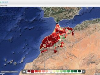
A map of Newfoundland and Labrador’s tsunami of offshore oil plans Satellite images show how Fiona’s surge sucked sand off P.E.I.’s shores New research tool looks back on 35 years of landscape changes from space […]