Esri Canada
Canadian Geospatial Digest for October 7th, 2024
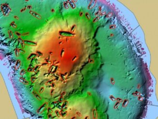
An Era Ends with the Retirement of the Canadian Digital Elevation Model (CDEM) State of the Canadian Space Sector 2023…
Canadian Geospatial Digest for July 1, 2024
Mapping Stolen Cars in Ottawa More than 830 vehicles have been reported stolen in Ottawa in the first six months…
Canadian Geospatial Digest for March 25th, 2024
How Indigenous companies are bringing high-tech solutions to the forest sector GIS in Mining: Strengthening Indigenous Communities Flood risk mapping…
Canadian Geospatial Digest December 11, 2023
The wildfire-fighting drones of the future. Restoring salmon habitat: An interactive map The maps selected for the 2024 Esri Canada…
Canadian Geospatial Digest October 2nd, 2023
Canada will be Launching a Satellite to Monitor Wildfires Canadian Housing Market Heat Island Effect in London, Ontario Esri Canada…
2023 GoGeomatics Back to School Socials & Pictures
The 8th annual GoGeomatics Back to School Socials were a great success! From coast to coast, we welcomed new and…
Canadian Geospatial Digest September 18th, 2023
Satellite Technology and Real-Time Water Sampling Enhance Blue-Green Algae Research in Alberta Two pioneering Canadian drone companies collaborate to fight…
Canadian Geospatial Digest May 29th, 2023
Why are hazard maps still lacking in NWT communities? Alberta wildfires are depicted on a digital map in near real-time.…
Canadian Geospatial Digest February 20th, 2023
City of Guelph chosen Canadian city to lead development of next-generation emergency services database First Nations say traditional knowledge should…
Canadian Geospatial Briefing May 16th: 1. Correlation between BC wildfires and floods 2. NG9-1-1 GIS Validator 3. NRCan migrated petabytes of geo data to the cloud 4. Aerial Imagery Cost-Sharing 5. RCMP using aerial images for missing people
Satellite mapping finds correlation between B.C. wildfires and floods Data scientists at SparkGeo, a geospatial company based in Prince George,…
Canadian Geospatial Briefing April 18th: 1. Esri Canada program director’s sudden passing; 2. Kanien’kéha mapping project; 3. Indigenous People’s Atlas of Canada; 4. Vernon floodplain maps; 5. Grassland mapping project
Esri Canada’s Program Director killed in small plane crash on March 21st John Bacon, Program Director in Esri Canada’s Geospatial…
Dr. Bob Maher receives the Roger F. Tomlinson Lifetime Achievement Award
Renowned educator and innovator established a world-class GIS program that has trained hundreds of geospatial leaders On GIS Day 2021,…