• facebook
  • Twitter
  • Linkedin
  • Youtube
  • Linkedin Group
  • Post a Job
  • Post an Ad
  • Post an Event
  • Post a Directory Listing
  • Post a Press Release
  • Media Kit
  • My Account
  • Login
GoGeomatics
  • MAGAZINE
    • BIM & GIS
    • Community
    • Conference news
    • Earth Observation
    • Education & Careers
    • GEOAI
    • Announcements
    • Reality Capture & Lidar
    • Science
    • Technology
    • Between the Poles
  • Directories
    • ASSOCIATION
    • INDUSTRY
    • EDUCATION
    • Open Data
  • EVENTS
    • GeoIgnite Events
    • Events Calendar
    • GoGeomatics Meetups
  • Services
    • Advertising
    • Marketing
    • Post a Job
    • Post an Ad
    • Post an Event
    • Post a Press Release
    • Post a Directory Listing
    • Media Kit
    • Web Design
  • Find a Job
  • Volunteer
    • Start a GoGeomatics Group
    • Editors & Writers Group
  • About Us
    • About Us
    • Contact Us
    • Frequently Asked Questions
  • Videos
Homeflood mapping

flood mapping

Community

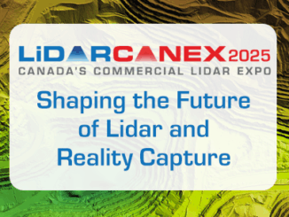
LidarCANEX 2025: Shaping the Future of Lidar and Reality Capture

26 November 2024 GoGeomatics Canada | 3D

Mark your calendars! LidarCANEX 2025, Canada’s premier Lidar Commercial Expo, is set to take place online on January 29-30, 2025. This highly anticipated event promises to bring together top lidar vendors, industry experts, and 3D […]

Technology

Canadian Geospatial Digest for October 7th, 2024

7 October 2024 Volunteer Editors and Group Writers | 2023 report

An Era Ends with the Retirement of the Canadian Digital Elevation Model (CDEM) State of the Canadian Space Sector 2023 Autonomous Food Delivery at the Toronto Zoo Uncovering the Legacy of Indigenous Residential Schools through […]

Technology

International Geospatial Digest for June 10th 2024

10 June 2024 Volunteer Editors and Group Writers | AI

New Map Shows Geothermal Energy Potential SWOT Transforms Flood Forecasting AI Mapping Helps Plan for Climate Change Moon Mapping Could Assist in NASA’s Artemis Missions AI-Enhanced User Experiences in ArcGIS Pro 3.3 Japan to Launch […]

Technology

Canadian Geospatial Digest for March 25th, 2024

24 March 2024 Volunteer Editors and Group Writers | ArcGIS

How Indigenous companies are bringing high-tech solutions to the forest sector GIS in Mining: Strengthening Indigenous Communities Flood risk mapping and public resistance in Canada Showing significant loss of affordable rentals in low-income Halifax neighbourhood […]

Technology

International Geospatial Digest for February 19th, 2024

19 February 2024 Volunteer Editors and Group Writers | aerial imagery

DLR develops mobile station for Satellite Laser Ranging Fathom and World Bank collaborate to enhance flood resilience Black communities are using mapping to document and restore a sense of place Eye in the sky: GIS […]

Community

FHIMP Invitation for Proposals: Funding Opportunities for Flood Hazard Identification and Mapping Projects

2 January 2024 Farzaneh Farshad | ESRI

Introduction The Flood Hazard Identification and Mapping Program (FHIMP) is a five-year initiative (2023-2028) led by Natural Resources Canada (NRCan) with the goal of enhancing flood preparedness and planning in Canada. This five-year program, spanning […]

Technology

International Geospatial Digest August 14, 2023

14 August 2023 Volunteer Editors and Group Writers | Climate Change

Landsat Data and Wetlands Overture Maps Foundation will Release Data US Flood Risk Map Florida Division of Emergency Management Creates Interactive Map Geospatial Mapping To Assist Burn Patients Laser mapping reveals a forgotten Maya city […]

|||||
Technology

Canadian Geospatial Digest February 20th, 2023

20 February 2023 Volunteer Editors and Group Writers | Acosys consulting

City of Guelph chosen Canadian city to lead development of next-generation emergency services database First Nations say traditional knowledge should help shape federal flood maps Sea urchins on the move How Ecopia AI’s Maps Are […]

Posts pagination

« 1 2 3 4 5 »

Events

Notice
There are no upcoming events.

View All Events

Services

  • Post a Job
  • Post an Ad
  • Post an Event
  • Post a Directory Listing
  • Post a Press Release
  • Media Kit
  • My Account
  • Login

Jobs

Post a Job
  • Operations Spatial Data Assistant (Contract)
    Vaughan
  • GIS Analyst
    Saint John, New Brunswick
  • GIS Student Intern
    Elmsdale, Nova Scotia
  • Canada Impact+ Research Chair – Professor (Or Associate Professor)
    Lethbridge, Alberta
View All Jobs
  • Directories
    • Associations Directory
    • Industry Directory
    • Education Programs
    • Open Data
  • Volunteer
    • Start a GoGeomatics Group
    • Editors & Writers Group
  • About Us
    • GoGeomatics Media Kit
    • Who We Are
    • Contact Us
    • FAQ’s
    • Advertising
    • Marketing
  • Subscribe
GoGeomatics
GoGeomatics is the largest and most popular communications hub promoting the Canadian geospatial community. The business was incorporated in 2011. GoGeomatics hosts over 100 fun, free, location technology networking events each year in cities across Canada.

© 2026 GoGeomatics

  • facebook
  • Twitter
  • Linkedin
  • Youtube
  • Linkedin Group