
- New Map Shows Geothermal Energy Potential
- SWOT Transforms Flood Forecasting
- AI Mapping Helps Plan for Climate Change
- Moon Mapping Could Assist in NASA’s Artemis Missions
- AI-Enhanced User Experiences in ArcGIS Pro 3.3
- Japan to Launch World’s 1st Wooden Satellite
New map shows vast potential for geothermal energy beneath entire US
GeoMap is a new geothermal exploration opportunities map currently being developed by Project InnerSpace in collaboration with Google.
The unveiling of GeoMap demonstrates the potential for geothermal energy in the United States. The western US has the most potential, while there are also promising areas in the eastern US. GeoMap will help researchers, planners, and the general public locate geothermal resources and identify the primary industries utilizing them.
The potential of geothermal energy may not be as evident as that of wind or solar power. Previously, the only way to determine if there was geothermal potential in a specific location was to drill a hole in the ground, which could be expensive. This tool will be valuable in assessing the presence of geothermal potential in an area.
Article can be viewed here
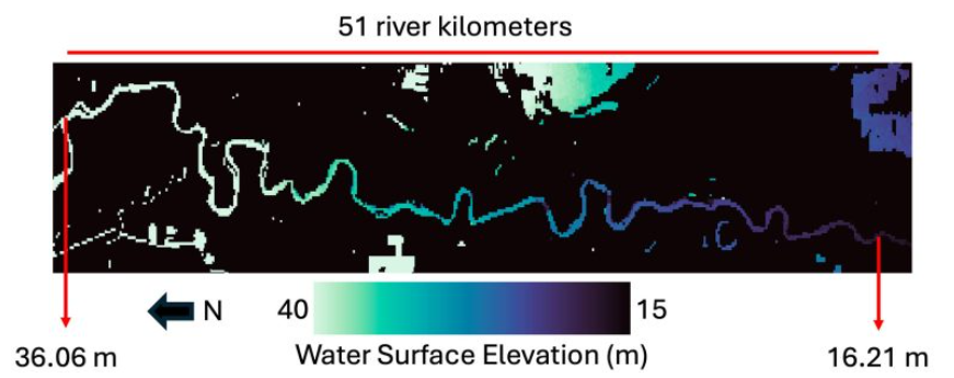
Mapping Earth’s Waterways From Space: How SWOT Transforms Flood Forecasting
With the collaboration between NASA and CNES (Centre National d’Études Spatiales), the Surface Water and Ocean Topography (SWOT) satellite is transforming flood prediction by supplying extensive data on water levels across almost all bodies of water on Earth. This satellite has been designed to measure wider rivers that are around 300 feet or greater in width, however, the initial findings show that it may also be able to measure much smaller rivers.
This satellite will help gather data in areas where stream gauges are sparse, nonexistent or disabled by floods, filling in the gaps in measurement coverage. Initiatives are underway to incorporate SWOT data into flood models, specifically the National Oceanic and Atmospheric Administration’s National Water Model. This model forecasts the likelihood and timing of flooding along rivers in the United States.
Article can be viewed here
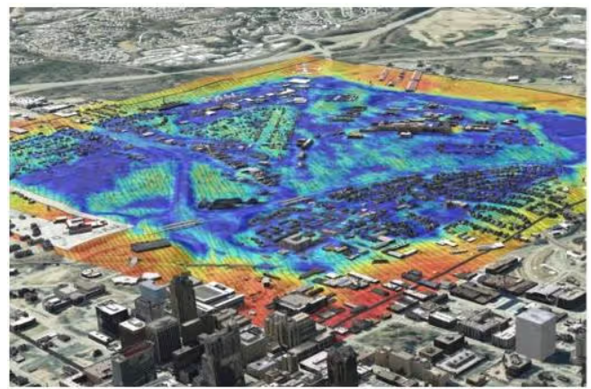
Raleigh’s hot: AI mapping helps plan for growth amid climate change
The heat has become so intense that red is no longer used to represent the hottest temperatures on weather maps. The National Weather Service and Centers for Disease Control have now added magenta to weather maps. This colour indicates an even more dangerous heat level caused by the increasing frequency and intensity of heat waves driven by climate change.
Planners in Rayleigh, North Carolina, are using Esri software to create a digital twin of the city. They are utilizing artificial intelligence to study the interaction between climate change and development. They want to further understand how road or building development could impact the temperature of their city.
Article can be viewed here
Moon-mapping could level up for NASA’s upcoming Artemis missions. Here’s how
Our current maps of the moon’s terrain are limited by their resolution, which would make the upcoming crewed Artemis missions challenging.
A new study is working on creating detailed maps of the lunar surface using terrain data from 2D maps. These lunar surface maps are created using open-sourced algorithms that can generate highly detailed maps, including individual features like boulders. These maps will be valuable for planning future crewed Artemis missions, as the landings will occur in the moon’s polar southern regions, which receive minimal light.

Article can be viewed here
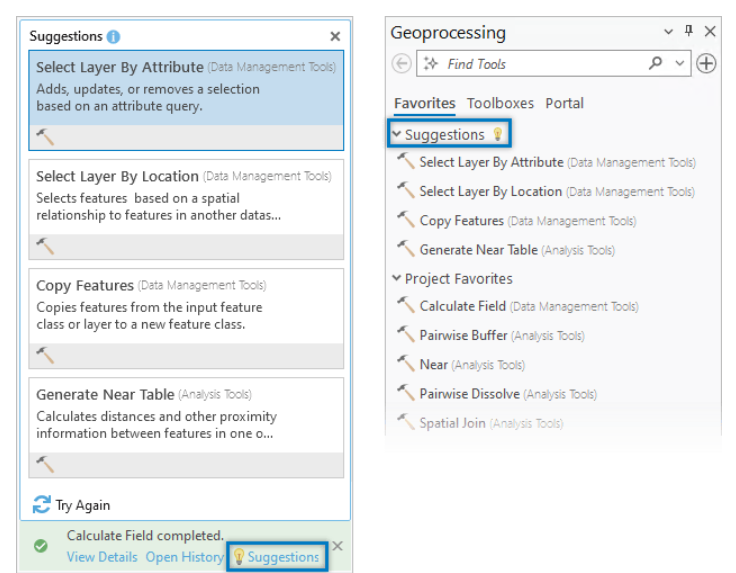
AI-Enhanced User Experiences in ArcGIS Pro 3.3
The new release of ArcGIS Pro 3.3 will feature AI assistance to help users find the right geoprocessing tools. With a semantic search engine, users will receive more accurate results for their search queries. Also, after running a geoprocessing tool, users will receive suggestions for tools that can assist them in completing their workflows.
Article can be viewed here
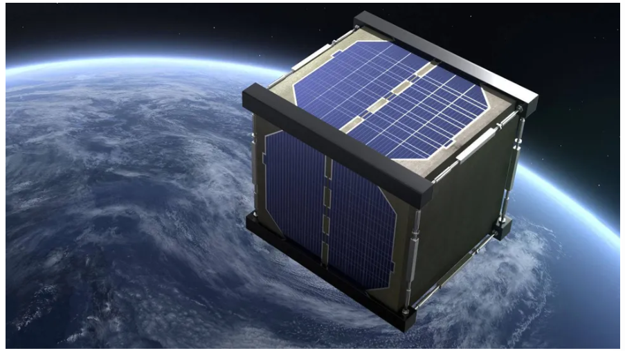
Japan to launch world’s 1st wooden satellite in September
In September, Japan plans to launch what would be the world’s first wooden satellite. Researchers at Kyoto University, in collaboration with Sumitomo Forestry, have developed LignoSat, a small wooden satellite measuring 10 centimetres on each side and weighing about two pounds. When traditional satellites burn up on re-entry into the Earth’s atmosphere, they release harmful metal particles. If LignoSat performs well, it could reduce the environmental impact of satellite re-entry.
Article can be viewed here


Be the first to comment