A Conversation with Jeff Clark
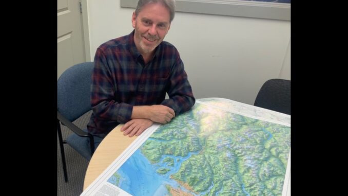
Jeff Clark is the principal and lead cartographer at Clark Geomatics, a map design studio based in North Vancouver, BC. With a professional background rooted in geophysics and GIS, Clark says:
I describe myself as an “accidental cartographer.”
Driven by a lifelong fascination with maps and a deep appreciation for detailed design, his journey into cartography has been shaped by both passion and professional evolution. Inspired by the belief that Canada’s most beautiful landscapes deserve high-quality, artistic representation, Clark set out to create maps that go beyond simple navigation or data display.
Particularly influenced by Swiss-style cartography and its masterful portrayal of topographic relief, Clark has skillfully combined technical expertise with artistic vision to produce “geographically expressive” maps—works that function not only as practical tools but also as visual interpretations of landscape and place.
Journey of Mapping technique and storytelling
As mapping technologies evolved, so did Jeff Clark’s approach to cartography. The rise of GIS, remote sensing, and terrain modelling transformed how landscapes could be represented, allowing detailed elevation models, bathymetry, and satellite imagery to become integrated, foundational design elements rather than simple, individual reference data layers. These advancements enabled spatial information to be processed and displayed at unprecedented levels of detail and scale.
Inspired by cartographer Dave Imus’ philosophy of Essential Geography and geographic expression, Clark shifted his focus from purely data-driven mapping toward revealing the most meaningful geographic relationships within a landscape.
His goal, which he shares with Imus, became not merely to present information, but to help people better visualize, understand, and connect with geography while developing a stronger sense of place. As technological tools became increasingly powerful, Clark’s methods grew more selective, refined, and intentional guided by thoughtful decisions about what matters most visually and geographically.
For Clark, storytelling lies at the heart of modern cartography. He stated:
By acting as a “careful editor” through the philosophy of Essential Geography, I move beyond a simple “data dump” to provide a “visual portrait” that helps build geographic literacy and environmental awareness.
He believes the world is geographically complex and that traditional, data-heavy maps often fail to communicate the interconnected systems that shape our environments. Instead, his maps aim to portray landscapes as connected wholes—places where rivers, mountains, ecosystems, and communities intersect—rather than as isolated scenic backdrops.
To foster geographic literacy and environmental awareness, Clark integrates Indigenous and colonial place names into his maps, acknowledging the deep historical and cultural relationships Indigenous peoples have maintained with the land since time immemorial. Through this inclusive approach, his work tells richer and more truthful stories of place, encouraging cross-cultural understanding and a deeper appreciation for the diversity and layered histories embedded within shared landscapes.
The Salish Sea Project – A Signature Project
“The Essential Geography of the Salish Sea” was designed by Clark to communicate the Salish Sea as a transnational bioregion, a deeply interconnected landscape shaped by relationships between land, water, mountains, settlements, and cultural histories. Below is a snapshot of the Salish Sea Map showcasing detailed boundaries, landuse, populated places, different means of transportation and locations & sites with a remarkable depth and intricacy.
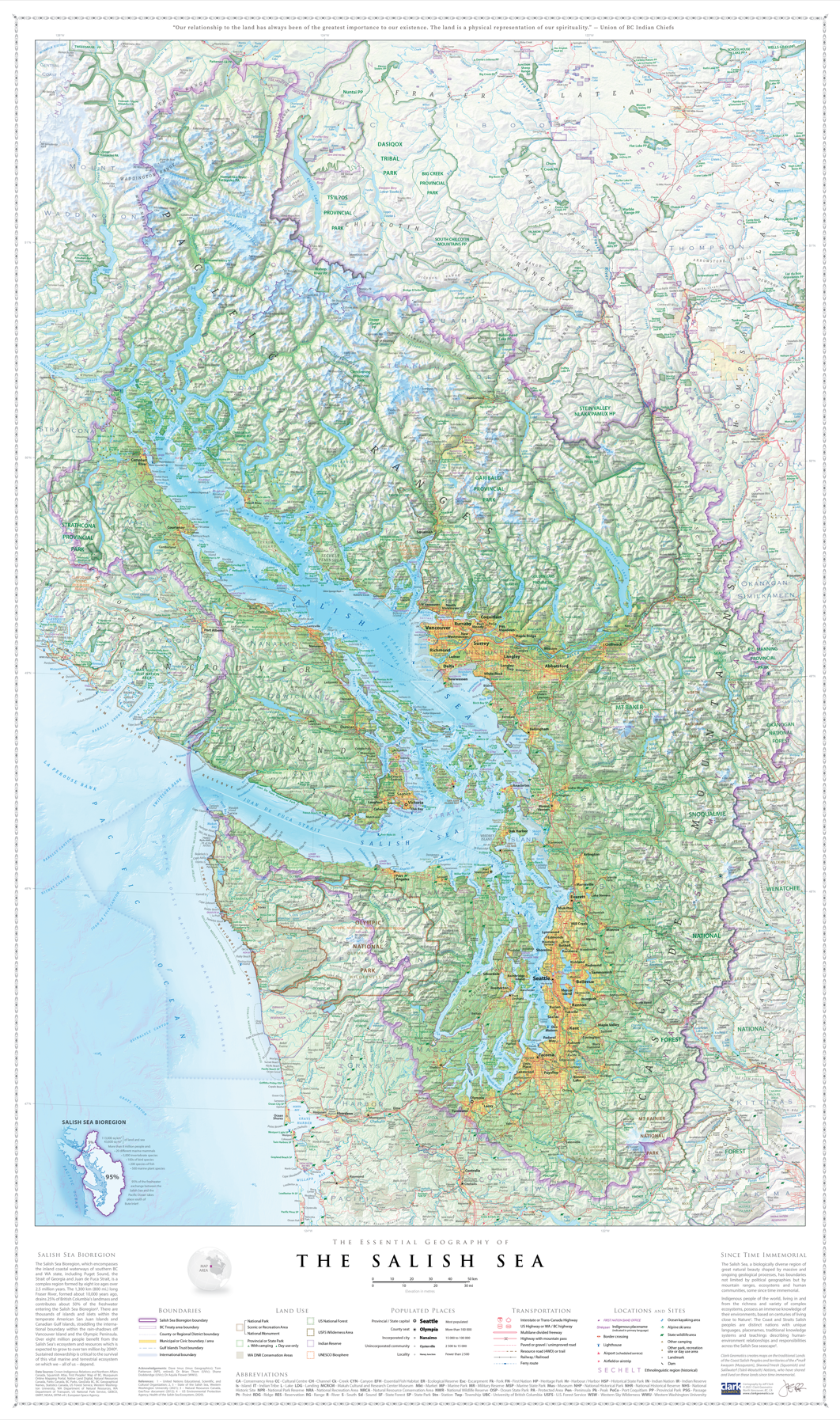
A key aspect of this work was the weaving together of both Indigenous and colonial place names, allowing for a more layered and truthful interpretation of the region. Using modern GIS and remote sensing tools, Clark was able to bring this vision to life by focusing on what is essential to understanding the region, resulting in a carefully crafted visual representation of a complex and interconnected landscape.
Perspective on Cartography in the AI Era
In an era where open data is democratizing mapmaking, Clark notes that access to information alone does not automatically produce strong cartography. The role of the professional cartographer increasingly lies in data interpretation, design judgment, visual communication, and geographic storytelling. The central challenge becomes how to organize, distill, and communicate complex spatial information in a meaningful way.
Working with an array of digital tools, including GIS, Blender, Natural Scene Designer, and Adobe Creative Suite—Clark emphasizes that technology should support and enhance the mapping process, but it should not dictate the final aesthetic outcome.
Today, I utilize AI as an effective geographic editor to help review and critique my draft maps. This is invaluable because distilling content while maintaining visual clarity is “infinitely iterative.”
He also suggests that as AI continues to evolve, it will likely enable even more intricate and realistic landscape renderings, building on capabilities already emerging in tools like Natural Scene Designer.
The Cartographer’s Balance: Accuracy and Usability
When there is an overwhelming amount of data available, achieving clarity without clutter becomes one of cartography’s greatest challenges, Jeff noted.
With the profusion of spatial data, the real challenge becomes how do we organize, distill and communicate that information meaningfully
Strongly aligning with the philosophy of cartographic pioneer Eduard Imhof, Jeff argued that clarity and beauty are not competing goals. An aesthetically pleasing map without sufficient geographic depth risks becoming visually attractive but informationally and contextually weak.
Effective cartography exists within a delicate balance between information density, readability, and visual harmony. Research-based design decisions, thoughtful symbology, and careful labelling are essential in helping readers interpret complex geographic relationships.
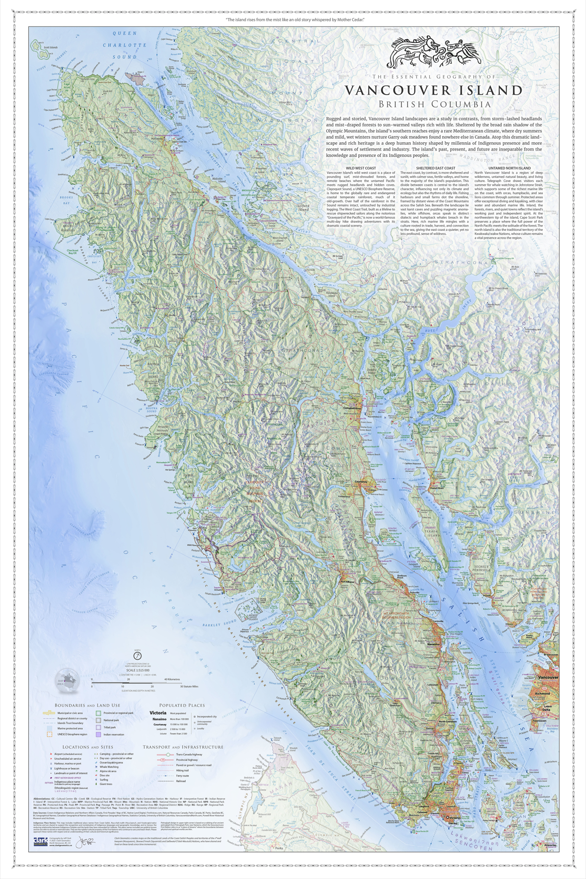
The image on the right features Clark’s Vancouver Island Map, a meticulously crafted depiction of the island emphasizing Wild West Coast, Sheltered East Coast & remote North Island.
Jeff emphasized that strong cartographers care deeply about landscapes and places—not merely the software used to represent them.
As AI continues to shape workflow automation, GIS, and web mapping, he believes the next generation must invest time in studying high-quality cartography, understanding why maps work visually, and developing the ability to evaluate and refine their own work.
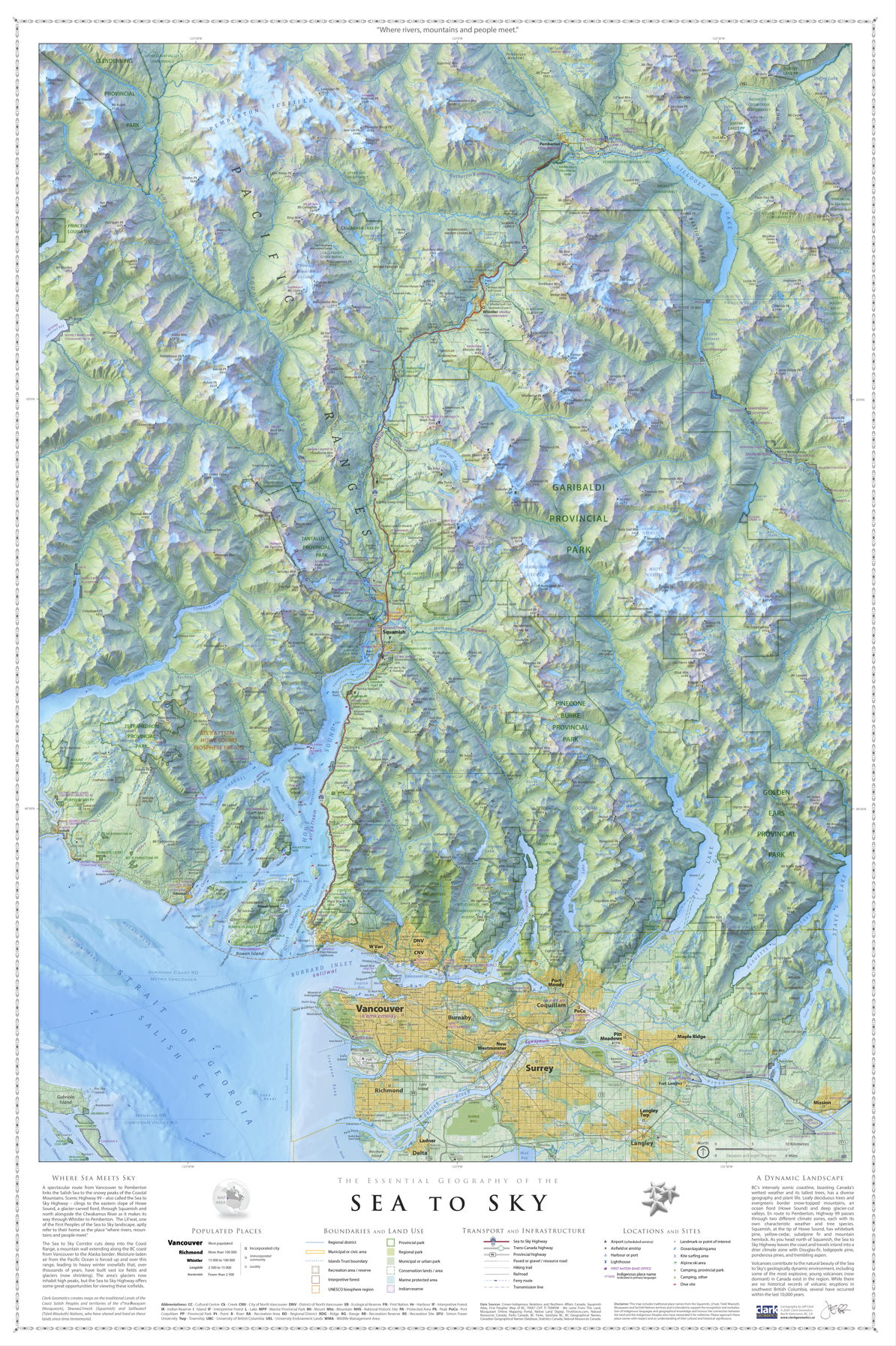
He also stressed the importance of building professional relationships and identifying underserved niche markets where specialized, high-quality cartographic services can stand out and command genuine interest. On the left is a snapshot of the Sea to Sky Map, capturing the region’s dramatic landscape where towering mountains rise from the coastline, creating the striking scenery that gives the area its name.
At the same time, Jeff expressed concern over the growing profusion of “low-effort maps” that are easily produced and widely circulated online. While digital tools have made mapmaking more accessible than ever, accessibility alone does not guarantee high quality cartography. The real challenge lies in transforming abundant data into maps that are both meaningful and memorable. Clark adheres to the notion that a map not properly designed will be a cartographic failure.
Looking Ahead: The Role of AI in the Future of Maps
AI is pushing the boundaries of how data can be portrayed and transformed into meaningful information. Jeff views
“AI as a critic and editorial partner”
From feature extraction, data processing, labelling, and feature generalization to workflow automation, AI is dramatically accelerating the technical dimensions of cartography. These tools are streamlining production and expanding creative possibilities, allowing cartographers to focus more on analysis and design.
However, the cartographer’s role remains indispensable. It is the cartographer’s responsibility to guide the narrative of a map, ensuring it is not only functionally accurate but also interpretable, contextually meaningful, and culturally sensitive. Human judgement and strategic interpretation remain vital for identifying data inaccuracies, understanding local nuances, and ensuring maps meet rigorous technical and design standards.
Closing Thoughts
In a world saturated with data and instant visualizations, Jeff’s approach to cartography stands apart grounded in research, guided by restrained design, and inspired by a genuine connection to landscape and place. His reflections offer both a challenge and an invitation to aspiring Canadian cartographers to look beyond the software, question their own work, and create maps that do more than display information. Design maps to reveal landscapes, honour its culture and history, and connect to the world around them.
See more of Jeff Clark’s work at Clark’s Studio & Maps


Be the first to comment