• facebook
  • Twitter
  • Linkedin
  • Youtube
  • Linkedin Group
  • Post a Job
  • Post an Ad
  • Post an Event
  • Post a Directory Listing
  • Post a Press Release
  • Media Kit
  • My Account
  • Login
GoGeomatics
  • MAGAZINE
    • BIM & GIS
    • Community
    • Conference news
    • Earth Observation
    • Education & Careers
    • GEOAI
    • Announcements
    • Reality Capture & Lidar
    • Science
    • Technology
  • Directories
    • ASSOCIATION
    • INDUSTRY
    • EDUCATION
    • Open Data
  • EVENTS
    • GeoIgnite Events
    • Events Calendar
    • GoGeomatics Meetups
  • Services
    • Advertising
    • Marketing
    • Post a Job
    • Post an Ad
    • Post an Event
    • Post a Press Release
    • Post a Directory Listing
    • Media Kit
    • Web Design
  • Find a Job
  • Volunteer
    • Start a GoGeomatics Group
    • Editors & Writers Group
  • About Us
    • About Us
    • Contact Us
    • Frequently Asked Questions
  • Videos
HomeFood Security

Food Security

TGi GIFS
Earth Observation

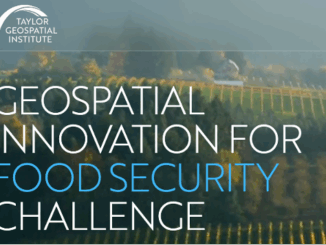
Taylor Geospatial Institute Launches $2 Million Innovation Challenge to Advance Food Security Through Geospatial Technology

18 August 2025 GoGeomatics Canada | academic-industry partnerships

St. Louis, MO — August 18, 2025 — Taylor Geospatial Institute (TGI) today announced the launch of the Geospatial Innovation for Food Security Challenge (GIFS). Through this Challenge, TGI will invest a total of up […]

Intl digest june 16
Community

International Geospatial Digest June 16, 2025

16 June 2025 Volunteer Editors and Group Writers | 3D Mapping

AI Foundation Models for Earth Observation: A New Chapter in Geospatial Intelligence FAO’s upgraded ABC-Map warns of a sharp decline in Crop Suitability by 2100 Real-Time GIS Dashboards Revolutionize Emergency Response  GlobalBuildingAtlas: First Complete Open […]

International Digest April 21||||
Community

International Geospatial Digest – April 21, 2025

21 April 2025 Volunteer Editors and Group Writers | AI

Meet Biomass, the Satellite Measuring the Carbon Content of Rainforests Google and AI – Geospatial Reasoning Mapping Seagrass Along the Italian Coast with Airborne Lidar Bathymetry Idea to Capture Vanguard-1, a Satellite from 1958 Senegal […]

International-Digest-Feb-24|||||||
BIM & GIS

International Geospatial Digest for February 24, 2025

24 February 2025 Volunteer Editors and Group Writers | drones

US Signals Potential Changes at NOAA UConn Researchers Tracking Change in Precious Ecosystems New UN Report Offers Insights into how Geospatial Technology can Advance Global Food Security Lost Cities of the Amazon: Science is Revealing […]

Events

Notice
There are no upcoming events.

View All Events

Services

  • Post a Job
  • Post an Ad
  • Post an Event
  • Post a Directory Listing
  • Post a Press Release
  • Media Kit
  • My Account
  • Login

Jobs

Post a Job
  • Canada Maps and Poster Gallery Volunteer Leads — GeoIgnite 2026
    remote
  • GIS & Data Analytics Lead
    Beaumont, AB
  • Lead Surveyor, Projects/Arpenteur-géomètre principal, projets; arpenteuse-géomètre principale, projets
    North Bay, Thunder Bay
  • Senior GIS Developer
    Calgary, AB
View All Jobs
  • Directories
    • Associations Directory
    • Industry Directory
    • Education Programs
    • Open Data
  • Volunteer
    • Start a GoGeomatics Group
    • Editors & Writers Group
  • About Us
    • GoGeomatics Media Kit
    • Who We Are
    • Contact Us
    • FAQ’s
    • Advertising
    • Marketing
  • Subscribe
GoGeomatics
GoGeomatics is the largest and most popular communications hub promoting the Canadian geospatial community. The business was incorporated in 2011. GoGeomatics hosts over 100 fun, free, location technology networking events each year in cities across Canada.

© 2025 GoGeomatics

  • facebook
  • Twitter
  • Linkedin
  • Youtube
  • Linkedin Group