germany
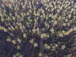
UAV Technology in the Canadian Forestry Sector
The Unmanned Aerial Vehicle (UAV) industry is soaring! Civilian drones are being applied in various global industries ranging from agriculture…
Hexagon takes top Honors in the Wichmann Innovations Award at INTERGEO 2015
Hexagon, a leading global provider of information technologies that drive productivity and quality across geospatial and industrial enterprise applications, recently…
GPS Galileo taking flight: ten satellites now in orbit
Europe’s own satellite navigation system has come a step nearer to completion, with Galileo 9 and 10 which lifted off…
SimActive Announces Correlator3DTM Version 6.2
Montreal, Canada, September 1st, 2015 – SimActive Inc., a world-leading developer of photogrammetry software, is pleased to announce Correlator3D™ version…
Canada Day Came Early at the Canada Aviation and Space Museum
June 23rd marked a special day in the history of aviation and space in Canada. A very special aircraft, a…
BlackBridge Signs Mongolian Partner MonMap
Berlin, Germany – On Friday, February 13, BlackBridge signed its 111th partner, the Mongolian geospatial company MonMap Engineering Services Co.,…
BlackBridge Unveils Concept for its New Mission
Enhanced capabilities, including very high resolution and superspectral bands, will be the new benchmark for commercial earth observation Berlin, Germany…
BlackBridge Secures $22 Million for New Satellite Constellation
A new generation of RapidEye Satellites is underway Berlin, Germany – BlackBridge has secured $22 million (CDN) in funding from…
PixR3 the new Gexcel imaging software for 3D point clouds extraction from UAV and terrestrial camera images
9th April, 2014, Brescia, Italy — Gexcel Srl, at the 2014 Faro User Meeting (Germany, 3-4 April), has released the…
Geospatial or Geomatics: The Headaches of Terminology in Canada
Great debates about the terms geomatics, geospatial, geoinformation and geoscience have occurred for decades. Additional terms like geoanalysis, geolocation, geocomputation…
Furthering Canada’s Geomatics Strategy: New Visions – New Direction – New Future
The recent publication of the ‘Canadian Geomatics Community Strategy “White Paper” and Scenarios’ has added another perspective toward furthering the development…
Immigrating to Canada for GIS Work: Interview with Madhur K Shrestha
GoGeomatics Canada had the chance to interview Madhur K Shrestha, a new arrival to Canada and a GIS specialist. We explore…