• facebook
  • Twitter
  • Linkedin
  • Youtube
  • Linkedin Group
  • Post a Job
  • Post an Ad
  • Post an Event
  • Post a Directory Listing
  • Post a Press Release
  • Media Kit
  • My Account
  • Login
GoGeomatics
  • MAGAZINE
    • BIM & GIS
    • Community
    • Conference news
    • Earth Observation
    • Education & Careers
    • GEOAI
    • Announcements
    • Reality Capture & Lidar
    • Science
    • Technology
  • Directories
    • ASSOCIATION
    • INDUSTRY
    • EDUCATION
    • Open Data
  • EVENTS
    • GeoIgnite Events
    • Events Calendar
    • GoGeomatics Meetups
  • Services
    • Advertising
    • Marketing
    • Post a Job
    • Post an Ad
    • Post an Event
    • Post a Press Release
    • Post a Directory Listing
    • Media Kit
    • Web Design
  • Find a Job
  • Volunteer
    • Start a GoGeomatics Group
    • Editors & Writers Group
  • About Us
    • About Us
    • Contact Us
    • Frequently Asked Questions
  • Videos
Homeglobe

globe

|
Community

BCIT Program Has the GIS Talent You Need

28 August 2015 Karl Kliparchuk | 2014

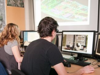
The BCIT GIS department has been graduating students for 25+ years.  Our students come from BC, but as well, across Canada and international.  Our program is known to be very demanding, and creates students that […]

|
Community

Canada Day Came Early at the Canada Aviation and Space Museum

7 July 2015 Robert Ryerson | 2014

June 23rd marked a special day in the history of aviation and space in Canada. A very special aircraft, a Convair-580, with its advanced Synthetic Aperture Radar (SAR) sensors, made its final flight after setting […]

No Picture
Newsmakers & Press Releases

UrtheCast Releases World’s First Full-Color HD Videos Of Earth From Space

17 June 2015 GoGeomatics Newsmakers | 2014

Videos of London, Boston, and Barcelona showcase life on Earth viewed from the International Space Station. VANCOUVER, June 17, 2015 – UrtheCast, the Earth Observation (EO) company aiming to open the world to anyone with […]

No Picture
Community

CloverPoint to Showcase Insight(TM) and Latest in Mapping Technology at TECTERRA 2015 Geomatics Show

15 June 2015 GoGeomatics Newsmakers | 2015

CloverPoint will be presenting our latest GIS, mapping, and land management solutions used by First Nations, and facility managers at the annual TECTERRA Geomatics Showcase in Calgary, Alberta #TECTERRASC15 CloverPoint, an established player in the […]

No Picture
Newsmakers & Press Releases

DigitalGlobe Produces the World’s First Complete and Consistent High Resolution Satellite Imagery Base Map of Africa

28 April 2015 GoGeomatics Newsmakers | 2015

Apr. 28, 2015– DigitalGlobe, Inc. (NYSE: DGI), a leading global provider of high-resolution earth imagery and geospatial solutions, today announced the general availability of its Basemap +Vivid product for the entire African continent. Keeping pace […]

No Picture
Newsmakers & Press Releases

PhotoSat verifies accuracy of DigitalGlobe’s 30 cm WorldView-3 satellite elevation data to within 15 cm

26 March 2015 GoGeomatics Newsmakers | 2015

VANCOUVER – PhotoSat is pleased to announce that the elevation data processed from DigitalGlobe’s new 30 centimeter resolution satellite, WorldView-3, has been verified as accurate to within 15 centimeters. DigitalGlobe is a leading global provider of […]

No Picture
Newsmakers & Press Releases

Intergraph and Esri Collaborate to Support Public Safety and Security

24 March 2015 GoGeomatics Newsmakers | 2015

Intergraph®, a global leader in public safety solutions, and Esri®, a global leader in GIS technology, are collaborating to enhance geospatial capabilities for public safety and security agencies. Through the collaboration, the companies will work […]

No Picture
Newsmakers & Press Releases

CloverPoint Celebrates 23 Years in Geospatial Technology

6 March 2015 GoGeomatics Newsmakers | 3D

CloverPoint, a leader in GIS, mapping, facilities management, and location technology is pleased to be celebrating 23 years in business. Victoria, B.C., Canada – CloverPoint, an established player in the GIS, mapping, 3D visualization, and […]

Posts pagination

« 1 … 4 5 6 … 10 »

Events

Notice
There are no upcoming events.

View All Events

Services

  • Post a Job
  • Post an Ad
  • Post an Event
  • Post a Directory Listing
  • Post a Press Release
  • Media Kit
  • My Account
  • Login

Jobs

Post a Job
  • Canada Maps and Poster Gallery Volunteer Leads — GeoIgnite 2026
    remote
  • GIS & Data Analytics Lead
    Beaumont, AB
  • Lead Surveyor, Projects/Arpenteur-géomètre principal, projets; arpenteuse-géomètre principale, projets
    North Bay, Thunder Bay
  • Senior GIS Developer
    Calgary, AB
View All Jobs
  • Directories
    • Associations Directory
    • Industry Directory
    • Education Programs
    • Open Data
  • Volunteer
    • Start a GoGeomatics Group
    • Editors & Writers Group
  • About Us
    • GoGeomatics Media Kit
    • Who We Are
    • Contact Us
    • FAQ’s
    • Advertising
    • Marketing
  • Subscribe
GoGeomatics
GoGeomatics is the largest and most popular communications hub promoting the Canadian geospatial community. The business was incorporated in 2011. GoGeomatics hosts over 100 fun, free, location technology networking events each year in cities across Canada.

© 2025 GoGeomatics

  • facebook
  • Twitter
  • Linkedin
  • Youtube
  • Linkedin Group