
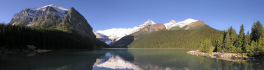
Community

It’s that time again! Time to take a look back at the last year on the Magazine and see which articles were the most popular with our readers. We had a lot of great reads […]
Last year GoGeomatics brought our readers up to date on the 2012 country report from NRCan to the United Nations. This year we are taking a look at some of the highlights of the 2014 […]

So, You Want to Be Employed? Some Advice for Graduate Students in Remote Sensing Robert A. Ryerson, Ph.D., CMS, FASPRS, President, Kim Geomatics Corporation ABSTRACT A number of things appear to be changing in the […]

Montreal, Canada, November25th, 2014 – The most important part of mapping, inspections and monitoring by robotic aircraft, is not the airshow – it’s the quality of the imagery and analysis that is enabled. SimActive Inc., […]
The Canadian Council on Geomatics (CCOG) has been around for over 40 years. Despite that, many people in geomatics aren’t aware of the significant role this federal-provincial-territorial government organization plays in the sector. To help […]
Ventus Geospatial Inc. is a leading provider of imaging gathered by unmanned aerial vehicles (UAVs) using fixed-wing planes and quad-copters. Ventus is one of a few Canadian companies to successfully receive a Blanket Special Flight […]
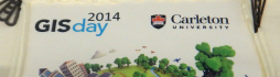
GoGeomatics celebrated GIS Day yesterday at Carleton University in Ottawa, part of the worldwide GIS Day celebrations. We would like to extend a big thank you to the MacOdrum Library‘s Maps, Data and Government Information Centre, […]