Community
How GIS and Remote Sensing Validate Indigenous-Led Stewardship
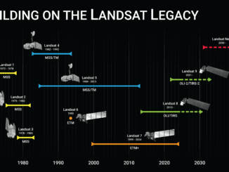
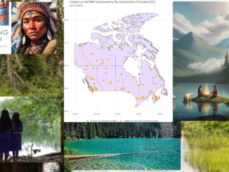
For decades, the conversation around conservation in Canada has been dominated by a “fortress” model—federal and provincial parks managed by central agencies. However, a landmark study released on January 6, 2026, by researchers at Concordia […]