• facebook
  • Twitter
  • Linkedin
  • Youtube
  • Linkedin Group
  • Post a Job
  • Post an Ad
  • Post an Event
  • Post a Directory Listing
  • Post a Press Release
  • Media Kit
  • My Account
  • Shopping Cart
  • Login
GoGeomatics
  • MAGAZINE
    • BIM & GIS
    • Community
    • Conference news
    • Earth Observation
    • Education & Careers
    • GEOAI
    • Announcements
    • Reality Capture & Lidar
    • Science
    • Technology
    • Between the Poles
  • Directories
    • ASSOCIATION
    • INDUSTRY
    • EDUCATION
    • Open Data
  • EVENTS
    • GeoIgnite Events
    • Events Calendar
    • GoGeomatics Meetups
  • Services
    • Advertising
    • Marketing
    • Post a Job
    • Post an Ad
    • Post an Event
    • Post a Press Release
    • Post a Directory Listing
    • Media Kit
    • Web Design
  • Find a Job
  • Volunteer
    • Start a GoGeomatics Group
    • Editors & Writers Group
  • About Us
    • About Us
    • Contact Us
    • Frequently Asked Questions
  • Videos
Homelocation intelligence

location intelligence

Hexagon Erdas
BIM & GIS

When Every Minute Counts: How Hexagon Tools Speed Up Geospatial Decisions

17 July 2025 Bruce Chaplin | agriculture

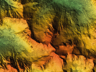
Farmers need to know which fields need water today, not next week. When satellite images sit unprocessed, crops suffer, and decisions get delayed. City planners stare at screens filled with infrastructure data, knowing somewhere in […]

Don Murray
BIM & GIS

Inside Safe Software’s Global Push: CEO Don Murray on Expansion, AI, and Staying Canadian

27 June 2025 Anusuya Datta | AI and Data

Safe Software, the Canadian company behind the FME platform, has expanded into the United Kingdom and Ireland — a strategic move aimed at strengthening its global footprint and accelerating growth across the Europe, Middle East, […]

Intl digest june 16
Community

International Geospatial Digest June 16, 2025

16 June 2025 Volunteer Editors and Group Writers | 3D Mapping

AI Foundation Models for Earth Observation: A New Chapter in Geospatial Intelligence FAO’s upgraded ABC-Map warns of a sharp decline in Crop Suitability by 2100 Real-Time GIS Dashboards Revolutionize Emergency Response  GlobalBuildingAtlas: First Complete Open […]

NG911|The Transition Timeline
BIM & GIS

Canada’s Next-Gen 9-1-1: The Upgrade Depends on the Maps You Don’t See

22 April 2025 Anusuya Datta | Canada Emergency Response

When Canadians dial 9-1-1 today, they expect to speak with someone who can send help. This voice-based system has served us for decades. But major changes are coming. Canada is replacing its legacy emergency system with Next […]

Earth Observation

It’s a Wrap! International Geospatial Digest for Dec 16, 2024

16 December 2024 Alefiya Dungrawala | 3D Infrastructure Sector

As 2024 comes to a close, let’s take a moment to reflect on some of the most significant stories that shaped the geospatial world this year. From groundbreaking AI model launches to major organizational mergers […]

Community

The International Map Industry Association and The World Geospatial Industry Council join the GoGeomatics Expo

30 May 2023 GoGeomatics Canada | Archaeology GIS

We are happy to announce that The International Map Industry Association (IMIA) and The World Geospatial Industry Council (WGIC) are joining as association sponsors for the GoGeomatics Expo in Calgary, taking place November 6 to […]

Technology

International Geospatial Digest May 8th, 2023

8 May 2023 Volunteer Editors and Group Writers | Air Pollution

US neighborhoods with more people of color suffer worse air pollution European Space and Telecoms Players Sign Partnership Agreement Climate change: Satellite maps warming impact on global glaciers The Growing Importance of Location Intelligence UK […]

|||||||
Community

LIKE ME Conference Addresses Climate Change at First Virtual Conference

23 June 2022 GoGeomatics Canada | carto

Industry experts and academia addressed climate change using geolocation intelligence at this year’s LIKE ME (Like Mother Earth) Conference. It was the first year the conference was ever held virtually. Held on February 16 and […]

Posts pagination

« 1 2 3 »

Events

Notice
There are no upcoming events.

View All Events

Services

  • Post a Job
  • Post an Ad
  • Post an Event
  • Post a Directory Listing
  • Post a Press Release
  • Media Kit
  • My Account
  • Shopping Cart
  • Login

Jobs

Post a Job
  • GIS Technician
    Sudbury, Ontario
  • Asset/GIS Coordinator
    Edson, AB
  • Civic Operations GIS Technologist (Permanent, Full-Time) – 1953
    Kamloops, British Columbia
  • Senior Manager, Data Science – Geospatial
    Mississauga, Ontario
View All Jobs
  • Directories
    • Associations Directory
    • Industry Directory
    • Education Programs
    • Open Data
  • Volunteer
    • Start a GoGeomatics Group
    • Editors & Writers Group
  • About Us
    • GoGeomatics Media Kit
    • Who We Are
    • Contact Us
    • FAQ’s
    • Advertising
    • Marketing
  • Subscribe
GoGeomatics
GoGeomatics is the largest and most popular communications hub promoting the Canadian geospatial community. The business was incorporated in 2011. GoGeomatics hosts over 100 fun, free, location technology networking events each year in cities across Canada.

© 2026 GoGeomatics

  • facebook
  • Twitter
  • Linkedin
  • Youtube
  • Linkedin Group