• facebook
  • Twitter
  • Linkedin
  • Youtube
  • Linkedin Group
  • Post a Job
  • Post an Ad
  • Post an Event
  • Post a Directory Listing
  • Post a Press Release
  • Media Kit
  • My Account
  • Shopping Cart
  • Login
GoGeomatics
  • MAGAZINE
    • BIM & GIS
    • Community
    • Conference news
    • Earth Observation
    • Education & Careers
    • GEOAI
    • Announcements
    • Reality Capture & Lidar
    • Science
    • Technology
    • Between the Poles
  • Directories
    • ASSOCIATION
    • INDUSTRY
    • EDUCATION
    • Open Data
  • EVENTS
    • GeoIgnite Events
    • Events Calendar
    • GoGeomatics Meetups
  • Services
    • Advertising
    • Marketing
    • Post a Job
    • Post an Ad
    • Post an Event
    • Post a Press Release
    • Post a Directory Listing
    • Media Kit
    • Web Design
  • Find a Job
  • Volunteer
    • Start a GoGeomatics Group
    • Editors & Writers Group
  • About Us
    • About Us
    • Contact Us
    • Frequently Asked Questions
  • Videos
Homemapping

mapping

BIM & GIS

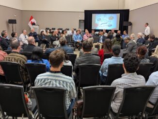
Key Discussion Themes for the Canadian Geomatics & Geospatial Advisory Forum at GoGeomatics Expo 2025

7 August 2025 GoGeomatics Canada | Canada

The Canadian Geomatics & Geospatial Advisory Forum will take place on November 3, 2025, during GoGeomatics Expo 2025 in Calgary. This free, open forum will bring together leaders and participants from government, private industry, academia, […]

Magazine

“The Culture Has to Change”: Terry Aucoin on Trust, Risk, and Rebuilding Procurement for Public Good

1 August 2025 Anusuya Datta | Canada

This interview is part of our series on Canada’s infrastructure moment and its impact on the geospatial/geomatics sector. With Canada committing 1.5% of GDP towards critical infrastructure and civil preparedness, the question now is: can […]

GEOAI

Mapping the AI Economy: A Brookings Report

30 July 2025 Jake MacLean | AI

With the growing emergence and explosion of AI in the last few years we have seen some incredible developments that are quickly becoming part of many people’s lives. A key aspect of geospatial is the […]

Indigenous Lands of Canada dataset
Community

Mapping More Than Land: Why Indigenous Place Names Matter Across Canada

30 July 2025 Kirstyn Howieson | Canada

The first time I traveled to Nunavut, I was told the region I was going to was a hamlet called Kugaaruk. Driving through the town with our local guide, I noticed the radio station was […]

Nick Kellett
BIM & GIS

Built for Big Players: Nick Kellett on Making Procurement Work for Small Tech

29 July 2025 Anusuya Datta | Canada

This interview is part of our series on Canada’s infrastructure moment and its impact on the geospatial/geomatics sector. Canada is on the cusp of a generational infrastructure shift, with the federal government pledging 5% of […]

BIM & GIS

“We’re Cutting the Pipeline”: Dr. Tim Webster on Canada’s Geospatial Education Crisis

28 July 2025 Anusuya Datta | AI in Geospatial

This is the third in a series of interviews exploring Canada’s geospatial education and workforce crisis. As the federal government accelerates infrastructure and defense investments, a quieter unraveling is underway: college and university programs in […]

BIM & GIS

From Smart Maps to Safer Communities: Canada’s New Era of Flood Resilience

27 July 2025 Farzaneh Farshad | AI in Flood Modeling

In June 2025, the Government of Canada announced a $6.8 million investment in 20 new flood-mapping and adaptation projects under the Flood Hazard Identification and Mapping Program (FHIMP). These initiatives promise to revolutionize how we […]

Carina
BIM & GIS

Canada’s Surveying Workforce Crisis: SAIT’s Carina Butterworth on Fixing the Pipeline

22 July 2025 Anusuya Datta | BCIT

Canada is entering a once-in-a-generation infrastructure boom — ports, roads, pipelines, renewable energy projects, and national security initiatives are all ramping up under the federal government’s 1.5% GDP commitment to critical infrastructure. But even before […]

Posts pagination

« 1 … 7 8 9 … 79 »

Events

Notice
There are no upcoming events.

View All Events

Services

  • Post a Job
  • Post an Ad
  • Post an Event
  • Post a Directory Listing
  • Post a Press Release
  • Media Kit
  • My Account
  • Shopping Cart
  • Login

Jobs

Post a Job
  • Survey Technicians (Field and Office)
    Calgary, Alberta
  • Geospatial Analytical Technician / Technicien, analyses gĂ©ospatiales; technicienne, analyses gĂ©ospatiales
    Peterborough
  • Volunteer Editorial Contributor – Be Part of Canada’s Geomatics Story
    Remote
  • Jr. GIS Analyst
    Hamilton
View All Jobs
  • Directories
    • Associations Directory
    • Industry Directory
    • Education Programs
    • Open Data
  • Volunteer
    • Start a GoGeomatics Group
    • Editors & Writers Group
  • About Us
    • GoGeomatics Media Kit
    • Who We Are
    • Contact Us
    • FAQ’s
    • Advertising
    • Marketing
  • Subscribe
GoGeomatics
GoGeomatics is the largest and most popular communications hub promoting the Canadian geospatial community. The business was incorporated in 2011. GoGeomatics hosts over 100 fun, free, location technology networking events each year in cities across Canada.

© 2026 GoGeomatics

  • facebook
  • Twitter
  • Linkedin
  • Youtube
  • Linkedin Group