Military
Canadian Geospatial Digest November 13, 2023
The prospect of space mining is growing more likely, and Canada may be a key player Black and grizzly bears…
International Geospatial Briefing Feb. 28th: 1. Indian government starts work on mapping villages. 2. Scottish space sector charts path to a sustainable future. 3. Five ways AI is saving wildlife. 4. Satellite images show military movements by Russia. 5. Underground Railroad secrets revealed with drones, lasers and radar. 6. NASA ‘NACHOS’ Instrument May Help Predict Volcanic Eruptions.
Indian Government starts work on mapping villages The Indian government is using geospatial technology and drones to map six lakh…
Your International Geospatial Briefing for June 10th: GeoIgnite Pub night; UNGGIM; UK Data exploration license; Maxar; AI in the military
GeoIgnite Conference Pub Night ByWard Market GoGeomatics and GeoIgnite will host a special pub social for attendees of the conference…
My COGS GIS Education
What About COGS The Centre of Geographic Sciences (COGS) is one of the best colleges in Canada for learning GIS. …
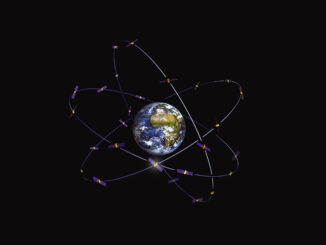
New Galileo navigation system is experiencing clock failures
Since December 15, 2016, the new Galileo global satellite navigation system has been up and running. Unfortunately, there are…
Marine Geomatics Primer: Using UUVs to Take Flight Underwater
Unmanned Underwater Vehicles One of the most interesting things to happen in regards to marine geomatics technology has been the…
Predicting the Future of the GIS in Canada
Editors note: This article has been jointly written by Bruce McCormack and Gordon Plunkett. Bios can be found at the…
Call to Action: Network of Concerned Geographers
Our growing network – the Network of Concerned Geographers – is pressuring the American Association of Geographers to study and…
Operational GIS Jobs in the Canadian Military
Whether its businesses, governments or for personal use, Geomatics offers everyday solutions to the worlds questions. The Canadian Armed Forces…
Montreal: SimActive Offers Free Trial of UAV Software
Montreal, Canada, October 11th, 2016 – SimActive Inc., a world-leading developer of photogrammetry software, is pleased to announce a new…
Earth Observation Represents a $43 Billion Opportunity Over Next 10 Years
NSR’s Satellite-Based Earth Observation (EO), 8th Edition report, released yesterday, projects data, value-added services, information products, and big data analytics…
Global GIS Market to Grow Steadily at a CAGR of More Than 10% by 2020
Technavios market research analyst predicts the global GIS market to grow steadily at a CAGR of more than 10% by…