• facebook
  • Twitter
  • Linkedin
  • Youtube
  • Linkedin Group
  • Post a Job
  • Post an Ad
  • Post an Event
  • Post a Directory Listing
  • Post a Press Release
  • Media Kit
  • My Account
  • Login
GoGeomatics
  • MAGAZINE
    • BIM & GIS
    • Community
    • Conference news
    • Earth Observation
    • Education & Careers
    • GEOAI
    • Announcements
    • Reality Capture & Lidar
    • Science
    • Technology
    • Between the Poles
  • Directories
    • ASSOCIATION
    • INDUSTRY
    • EDUCATION
    • Open Data
  • EVENTS
    • GeoIgnite Events
    • Events Calendar
    • GoGeomatics Meetups
  • Services
    • Advertising
    • Marketing
    • Post a Job
    • Post an Ad
    • Post an Event
    • Post a Press Release
    • Post a Directory Listing
    • Media Kit
    • Web Design
  • Find a Job
  • Volunteer
    • Start a GoGeomatics Group
    • Editors & Writers Group
  • About Us
    • About Us
    • Contact Us
    • Frequently Asked Questions
  • Videos
HomeNatural Resources Canada

Natural Resources Canada

No Picture
Newsmakers & Press Releases

Canada Takes Part: Arctic Spatial Data Infrastructure Meets in Anchorage

26 July 2016 GoGeomatics Newsmakers | 2014

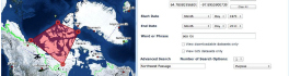
The Arctic SDI Board, which includes mapping executives from Canada, Kingdom of Denmark, Finland, Iceland, Norway, Russia, Sweden and the United States, recently met in Anchorage, Alaska to further development of a robust Arctic Spatial […]

No Picture
Community

GeoAlliance Canada Threatens to Sue GoGeomatics Canada Over Cartoon

23 February 2016 Jon Murphy | alberta

I am sharing an email GoGeomatics received from the delicate flowers at GeoAlliance Canada.  We got it a few hours after GoGeomatics published a cartoon on February 22nd.   I will leave it to the community […]

No Picture
Community

Web Framework for Flood Risk Assessment: Elevation Services and Simplified Flood Models

5 December 2015 Heather McGrath | accuracy

The development of infrastructure and dense urbanization along water courses and the increasing severity of storm events has brought to focus the need for methods for evaluating the potential negative impact to communities. While many […]

No Picture
Technology

Elevation Web Services: Limitations and Prospects

2 November 2015 Emmanuel Stefanakis | 2014

Elevation Web Services: Limitations and Prospects Elevation data is necessary for a wide range of geospatial applications such as creating relief maps and rendering 3D visualizations, deriving the slope and aspect of a geographic area, […]

|||
Technology

Open Data Portals and Geomatics: The Polar Data Catalogue

9 July 2015 Garret Reid | 2012

The growing interest in providing open data access has long been integrated into the field of Geomatics. However, the use of Geomatics within open data portals is relatively uncommon. This inclusion provides an interactive and […]

No Picture
Newsmakers & Press Releases

MDA to operate Canada’s ground station infrastructure and expand its international business

29 June 2015 GoGeomatics Newsmakers | antennas

Richmond, BC – MacDonald, Dettwiler and Associates Ltd., a global communications and information company, today announced that it has signed a contract for CA$7.4 million with Natural Resources Canada (NRCan). MDA will provide In-Service Support […]

|
Community

Speaker Series: Federal Geospatial Platform at Ottawa February Social

29 January 2015 GoGeomatics Canada | agriculture

The Ottawa February GoGeomatics Social is taking place Friday, February 27, 6:00PM in the basement of the James Street Pub. This month, we have a great speaker lined up to tell you all about a […]

|
Community

A Breakdown of the NRCan 2014 Geomatics Country Report of Canada for the United Nations

11 December 2014 GoGeomatics Canada | 2012

Last year GoGeomatics brought our readers up to date on the 2012 country report from NRCan to the United Nations. This year we are taking a look at some of the highlights of the 2014 […]

Posts pagination

« 1 … 5 6 7 … 10 »

Events

Notice
There are no upcoming events.

View All Events

Services

  • Post a Job
  • Post an Ad
  • Post an Event
  • Post a Directory Listing
  • Post a Press Release
  • Media Kit
  • My Account
  • Login

Jobs

Post a Job
  • Geospatial Analytical Technician / Technicien, analyses gĂ©ospatiales; technicienne, analyses gĂ©ospatiales
    Peterborough
  • GIS Technologist II
    Fernie, B.C.
  • GIS I TECHNOLOGIST
    Fernie, B.C.
  • Senior Geohazards Specialist
    Ottawa
View All Jobs
  • Directories
    • Associations Directory
    • Industry Directory
    • Education Programs
    • Open Data
  • Volunteer
    • Start a GoGeomatics Group
    • Editors & Writers Group
  • About Us
    • GoGeomatics Media Kit
    • Who We Are
    • Contact Us
    • FAQ’s
    • Advertising
    • Marketing
  • Subscribe
GoGeomatics
GoGeomatics is the largest and most popular communications hub promoting the Canadian geospatial community. The business was incorporated in 2011. GoGeomatics hosts over 100 fun, free, location technology networking events each year in cities across Canada.

© 2026 GoGeomatics

  • facebook
  • Twitter
  • Linkedin
  • Youtube
  • Linkedin Group