Northwest Territories

Canadian Geospatial Digest May 29, 2023

Canadian Geospatial Digest May 29th, 2023

Why are hazard maps still lacking in NWT communities? Alberta wildfires are depicted on a digital map in near real-time.…

44th CSRS: Remote Sensing For A Resilient Future Monitoring Our Dynamic Environment

  For 2023, the 44th Canadian Symposium on Remote Sensing will be co-hosted by the University of Lethbridge and the…

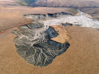
Making Sense of Permafrost Landslides with Government of NWT

Remote Sensing is Finding Answers in the Northwest Territories Remote Sensing is proving itself to be part of the solution…

From floppy disks to cloud computing – Exploring 35 years of Remote Sensing in the NWT

In 1987, Frobisher Bay was renamed Iqaluit, the loonie was released by the Canadian mint, and there were 13 UTM…

Pingo

The Mystery and Magic of the Mighty Pingo

Pingo, the name itself got me curious to find out more about it. Not to be confused with Pingu (The…

Canadian flag

Ten Interesting Facts about the Geography of Canada

This year Canada will celebrate its 150th birthday on July 1st. Most of you, like me, will be out celebrating…

Geospatial Career: Finding a GIS Job

Sometimes it seems like jobs are getting harder to find in the geospatial sector. That’s because it is hard, especially…

Expansion at Inuvik Satellite Station Facility from Swedish Space Corporation

The Swedish Space Corporation (SSC) is increasing its capacity at the Inuvik Satellite Station Facility in Inuvik, Canada, with the…

A Breakdown of the NRCan 2014 Geomatics Country Report of Canada for the United Nations

Last year GoGeomatics brought our readers up to date on the 2012 country report from NRCan to the United Nations.…

GIS Day is Just around the Corner

This November 19, the geomatics world will celebrate the 15th annual GIS Day. GIS Day is part of Geography Awareness…