nvidia
International Geospatial Digest for April 1st 2024
Use of remote sensing and GIS technologies to reduce deforestation in Africa Vermont Uses Site Scan for ArcGIS and ArcGIS…
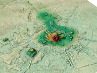
International Geospatial Briefing July 11th: 1. Quarter of Earth’s Seafloor Mapped; 2. Seabed Mapping App; 3. NOAA Joins Effort to Map Ocean Floor; 4. UN Satellite Centre and NVIDIA Boost Sustainable Development Goals; 5. Geospatial Workforce Challenges; 6. Digital mapping settlements in the pre-Columbian Amazon
Nearly a quarter of Earth’s seafloor now mapped The Seabed 2030 project aims to have the entire earth’s seafloor mapped…
International Geospatial Briefing March 28th: 1. Ukraine War Called ‘Catalyst’ for Space-Based Remote Sensing Industry 2. International Sea Level Satellite Takes Over From Predecessor 3. Nvidia launched a mapping product for the autonomous vehicle industry 4. Infotech Partners with Cultivate Geospatial Solutions 5. Nasa Urged to extend life of key climate sensor that maps world’s forests
Ukraine War Called ‘Catalyst’ for Space-Based Remote Sensing Industry The war in Ukraine is bringing remote sensing technology to the…
Project Anywhere – Cesium collaboration with Unreal Engine, Microsoft and NVIDIA
Cesium started off in 2011, with a team of developers at an aerospace software company to create an application to…