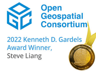
OGC
CubeWerx announces multi-year contract Saskatchewan Geospatial Imagery Collaborative (SGIC)
CubeWerx announced today it has signed a four-year contract to provide managed imagery services to the Saskatchewan Geospatial Imagery Collaborative…
Your Canadian Geospatial Briefing for November 13th: NRCan and OGC; RASC; Concordia University; Canada’s Commemorative Map; IN-FLIGHT Data
NRCan becomes OGC strategic member GeoConnections of Natural Resources Canada (NRCan) has upgraded to the highest level of membership—strategic member—in…
Free Open Geospatial Consortium Technology Trends Webinar
Date: Tuesday, September 4, 2018 Time: 10:00 – 11:00 EDT GeoConnections is extending an invitation to the webinar, “Open Geospatial Consortium Technology…
Earth Observation Exploitation Platform: OGC seeks your input on draft charter
The Open Geospatial Consortium (OGC) seeks comments on the draft charter of a proposed Earth Observation Exploitation Platform Domain Working…
Geomatics Web Services Used in Recent Quebec Floods
Editors note: This article has been jointly written by Nicolas Gignac and Serge Legaré from the Ministry of Public Safety…
GeoPackage: A format with database capabilities
A couple of months ago the Open Geospatial Consortium (OGC) sought public comment [1] on the new version of GeoPackage…
The Open Geospatial Consortium (OGC): proposed GeoRSS Community Standard
The Open Geospatial Consortium (OGC®) is requesting public comment on the proposed GeoRSS Community Standard. First available in 2006, GeoRSS…
Free Webinar March 15th: NRCan, OGC, & USGS Arctic Spatial Data Pilot Demonstration
The Canada Centre for Mapping and Earth Observation invites you to attend the Arctic Spatial Data Pilot Demonstration Webinar. Managed and…
Canadian Geomatics Innovation: Ecere Develops a Next Generation GIS
Not many companies undertake the ambitious goal of creating a new geospatial software suite from scratch. Ecere, a Canadian company…
Open Geospatial Consortium adopts the OGC SensorThings API as an official standard
The Open Geospatial Consortium (OGC®) has adopted SensorThings API Part 1: Sensing as an official standard. The OGC SensorThings API…
Canada Takes Part: Arctic Spatial Data Infrastructure Meets in Anchorage
The Arctic SDI Board, which includes mapping executives from Canada, Kingdom of Denmark, Finland, Iceland, Norway, Russia, Sweden and the…
NetCDF: a growing standard for encoding georeferenced data in binary form
Recently, the Open Geospatial Consortium (OGC) has announced an extension to the OGC CF-netCDF 3.0 encoding standard that specifies how…