precision

Kongsberg Gallium becomes Kongsberg Geospatial

The move is part of a comprehensive rebranding strategy to more effectively align the Company’s name with its future strategy…

Latest model of Optech Lynx and results from Highways England at TRB 95th Annual Meeting

Teledyne Optech is pleased to announce that it will introduce the latest model of its Lynx mobile lidar system, the…

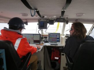
Geomatics: Discovering history in Canada’s Arctic waters

This article was reprinted with permission from the Ontario Professional Surveyor, Volume 56, No. 3, Summer 2015 By Theresa Nicholsi,…

Adam Chrzanowski Becomes Honorary President of Peruvian Congress on Geodesy and Geomatics

Organizers of a new Peruvian Congress on Geodesy and Geomatics have asked Dr. Adam Chrzanowski, Professor Emeritus in the Department…

EnWin Utilities Recognized for Using GIS to Improve Access to Key Operational Information

Consolidating hydro and water network data into a single geodatabase provides better decision support London, Esri Canada User Conference –…

Government of Canada Unveils 3D Model of HMS Erebus

Data collected by the Department of Fisheries and Oceans’ Canadian Hydrographic Service used to develop models of HMS Erebus FREDERICTON,…

UAV Manufacturer Draganfly Innovations Inc. Offers Agricultural Remote Sensing Solutions

Draganfly Innovations Inc. releases an advanced precision agriculture solution that redefines the way agricultural data is collected and viewed. The…

IGN France International Opts for SimActive’s Correlator3D™

Montreal, Canada, March 11th, 2015 – SimActive Inc., a world-leading developer of photogrammetry software, is pleased to announce the purchase…

PrecisionHawk and Agri-Trend Partner to Offer First, Full Service Drone and Data Solution to Farmers

Agri-Trend clients will have access to the PrecisionHawk Drone Platform, Sensors and Data Mapping tools with the expectation to fully…

Farmers Edge Acquires GranDuke Geomatics as Precision Agriculture Market Grows

With operations around the world, Farmers Edge Inc. promotes Innovation in Precision Agriculture Winnipeg, MB – Farmers Edge Inc., a…

BlackBridge Signs Mongolian Partner MonMap

Berlin, Germany – On Friday, February 13, BlackBridge signed its 111th partner, the Mongolian geospatial company MonMap Engineering Services Co.,…

SkyIMD and Phase One Industrial Announce SkyIMD’s Introduction of FAA-Approved Mounts

Approved for commercial aviation in 56 countries SAN FRANCISCO and COPENHAGEN, Feb. 26, 2015 — Sky Imaging Mapping Data (SkyIMD),…