• facebook
  • Twitter
  • Linkedin
  • Youtube
  • Linkedin Group
  • Post a Job
  • Post an Ad
  • Post an Event
  • Post a Directory Listing
  • Post a Press Release
  • Media Kit
  • My Account
  • Login
GoGeomatics
  • MAGAZINE
    • BIM & GIS
    • Community
    • Conference news
    • Earth Observation
    • Education & Careers
    • GEOAI
    • Announcements
    • Reality Capture & Lidar
    • Science
    • Technology
  • Directories
    • ASSOCIATION
    • INDUSTRY
    • EDUCATION
    • Open Data
  • EVENTS
    • GeoIgnite Events
    • Events Calendar
    • GoGeomatics Meetups
  • Services
    • Advertising
    • Marketing
    • Post a Job
    • Post an Ad
    • Post an Event
    • Post a Press Release
    • Post a Directory Listing
    • Media Kit
    • Web Design
  • Find a Job
  • Volunteer
    • Start a GoGeomatics Group
    • Editors & Writers Group
  • About Us
    • About Us
    • Contact Us
    • Frequently Asked Questions
  • Videos
Homepreservation

preservation

Technology

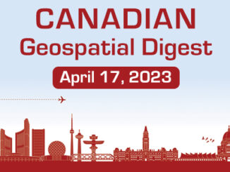
Canadian Geospatial Digest April 17th, 2023

17 April 2023 Volunteer Editors and Group Writers | 3D scanning

Minerva Intelligence launches Canada’s first wildfire risk map using AI and ML Alberta grain elevators preserved in virtual reality W5, CTV creates a map of asbestos cement pipes delivering drinking water in Canada University of […]

|||||
Technology

Canadian Geospatial Digest for August 1, 2022

1 August 2022 GoGeomatics Canada | 2D

Endangered BC Heritage Site Digitally Preserved by University Professors Edelweiss Village, a heritage site in British Columbia (BC), is the birthplace of mountaineering culture in Canada. The village is being sold for $2.3 million.  The […]

||||
Education & Careers

Canadian Surveyors “Remark” on History with Elk Pass Boundary Restoration Survey

17 October 2016 Association of British Columbia Land Surveyors | 2012

The Alberta-British Columbia Boundary Commission has just completed a monument restoration survey to restore a number of deteriorated provincial boundary monuments in the Elk Pass area of the Rocky Mountains. The work was undertaken by […]

No Picture
Education & Careers

Putting Map Making Back Into the Hands of the Community

19 April 2016 Robert Maher | annapolis

On April 7th, I attended the community mapping showcase at the NSCC Centre of Geographic Sciences (COGS). This project is a collaboration between the Age Advantage Association, a not-for-profit group of seniors in the Annapolis […]

No Picture
Community

Ottawa CCRS Speaker Series: The Halifax air photo mission of 1921 post-WW1 air surveys in Canada

2 November 2015 GoGeomatics Canada | 2015

Mr. Dirk Werle, Partner / Geoscientist, Ærde Environmental Research, Halifax Date: Friday, November 13, 2015 Time: 10:30 – 12:00 Location: Room O-23, 560 Rochester Street Speaking on: Setting the Sights on the Cities: The Halifax […]

No Picture
Newsmakers & Press Releases

Trimble Introduces Next Generation Indoor Mobile Mapping System

1 October 2015 GoGeomatics Newsmakers | 2016

TIMMS 2–Smaller, Lighter and Easier to Maneuver System Maximizes Performance in Indoor Spaces While Delivering Accurate, High-Quality Data Trimble (NASDAQ: TRMB) introduced its next generation Trimble® Indoor Mobile Mapping Solution (TIMMS) that produces fast and […]

|||
Technology

Open Data Portals and Geomatics: The Polar Data Catalogue

9 July 2015 Garret Reid | 2012

The growing interest in providing open data access has long been integrated into the field of Geomatics. However, the use of Geomatics within open data portals is relatively uncommon. This inclusion provides an interactive and […]

|||
Community

AquaHacking for the Future of the Ottawa River

27 March 2015 GoGeomatics Canada | application

AquaHacking is a new app challenge with an environmental focus – on the preservation of the Ottawa River. Presented by the de Gaspé Beaubien Foundation, in partnership with Ottawa Riverkeeper and IBM, AquaHacking aims to […]

Posts pagination

1 2 »

Events

Notice
There are no upcoming events.

View All Events

Services

  • Post a Job
  • Post an Ad
  • Post an Event
  • Post a Directory Listing
  • Post a Press Release
  • Media Kit
  • My Account
  • Login

Jobs

Post a Job
  • Canada Maps and Poster Gallery Volunteer Leads — GeoIgnite 2026
    remote
  • GIS & Data Analytics Lead
    Beaumont, AB
  • Lead Surveyor, Projects/Arpenteur-géomètre principal, projets; arpenteuse-géomètre principale, projets
    North Bay, Thunder Bay
  • Senior GIS Developer
    Calgary, AB
View All Jobs
  • Directories
    • Associations Directory
    • Industry Directory
    • Education Programs
    • Open Data
  • Volunteer
    • Start a GoGeomatics Group
    • Editors & Writers Group
  • About Us
    • GoGeomatics Media Kit
    • Who We Are
    • Contact Us
    • FAQ’s
    • Advertising
    • Marketing
  • Subscribe
GoGeomatics
GoGeomatics is the largest and most popular communications hub promoting the Canadian geospatial community. The business was incorporated in 2011. GoGeomatics hosts over 100 fun, free, location technology networking events each year in cities across Canada.

© 2025 GoGeomatics

  • facebook
  • Twitter
  • Linkedin
  • Youtube
  • Linkedin Group