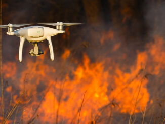
• facebook
  • Twitter
  • Linkedin
  • Youtube
  • Linkedin Group
  • Post a Job
  • Post an Ad
  • Post an Event
  • Post a Directory Listing
  • Post a Press Release
  • Media Kit
  • My Account
  • Login
GoGeomatics
  • MAGAZINE
    • BIM & GIS
    • Community
    • Conference news
    • Earth Observation
    • Education & Careers
    • GEOAI
    • Announcements
    • Reality Capture & Lidar
    • Science
    • Technology
  • Directories
    • ASSOCIATION
    • INDUSTRY
    • EDUCATION
    • Open Data
  • EVENTS
    • GeoIgnite Events
    • Events Calendar
    • GoGeomatics Meetups
  • Services
    • Advertising
    • Marketing
    • Post a Job
    • Post an Ad
    • Post an Event
    • Post a Press Release
    • Post a Directory Listing
    • Media Kit
    • Web Design
  • Find a Job
  • Volunteer
    • Start a GoGeomatics Group
    • Editors & Writers Group
  • About Us
    • About Us
    • Contact Us
    • Frequently Asked Questions
  • Videos
HomePublic Sector Digest

Public Sector Digest

|||||||||||
Technology

Canadian Wildfire Mapping Resources 2021 Fire Season

30 July 2021 Saeideh Hejazi | air quality health index

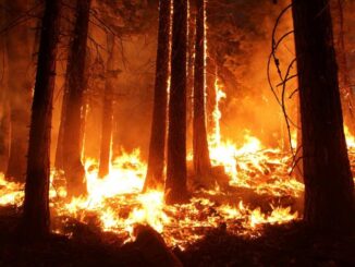
Western Canada has been experiencing extreme fire conditions following an intense heatwave since late June. According to BC Wildfire Service, 243 wildfires are currently burning in British Columbia. Due to the fire threats, many residents […]

Community

Avenza Quality Cartographic Output For Data With Adobe Illustrator & MAPublisher – GeoIgnite 2021 Talk On YouTube:

23 July 2021 GoGeomatics Canada | adobe illustrator

Adobe Illustrator is not a tool you’d associate with geospatial work, but Avenza is here to show you how to use this software for your cartographic needs! In this talk on Day Three of the […]

|
Community

GIS & Beyond: Smart Software Solutions Made In Poland from GISPartner, GeoIgnite 2021 Talk On YouTube

22 July 2021 GoGeomatics Canada | Bartlomiej Grabowski

Day Three of the GeoIgnite conference featured Gold Sponsor GISPartner. They continue to make waves as a dynamically developing European company, active in field of GIS professional services market in Poland. Their main aim is […]

||
Technology

Disaster Management Made Difficult by the Pandemic – Drones to the Rescue!

21 July 2021 Zarin Mom | Canada

Natural disasters, to say the least, have jeopardized the livelihood of millions, and the Rohingya refugees in Bangladesh are not unfamiliar with the displacement and famine that follows (The World Bank, 2021). The 1.1 million […]

||||||||||||||||||
Technology

A History of Everest Mapping

20 July 2021 Khimlal Gautam | 3D Mapping

As awe inspiring as the mountain is, so are the maps. Mount Everest is often considered “a symbol of something impossible”. For mountaineers standing atop Everest, near the Nepal-China border on the huge ice block […]

|||||
Community

Centre of Geographic Sciences (COGS) Opens $9 million Geographic Innovation Centre and Residence

17 July 2021 GoGeomatics Canada | Canada

On July 6th, Iain Rankin, Nova Scotia’s premier, was in the Annapolis Valley to unveil the provinces 9 million dollar investment in the growing global location technology sector. Joining him were NSCC President Don Bureaux […]

Community

Planet: “Advances in Earth Observation & Analytics Technologies + Deployment in Forest & Climate Solutions” – YouTube Video GeoIgnite 2021

15 July 2021 GoGeomatics Canada | Climate Change

Every day, Planet images the full Earth at 3.5m resolution and anywhere sub-daily at <50cm. This data is critical in working to make global change visible, accessible, and actionable in regards to climate change. On […]

Community

Geospatial Metadata: The Ties That Bind- Tobias Spears, Head of the Ocean Data & Information Section at Fisheries & Oceans Canada – GeoIgnite Talk on YouTube

14 July 2021 GoGeomatics Canada | Canada

The Government of Canada and organizations such as the UN recognize the critical role of standards in geographic information and geomatics to support stewardship and interoperability of information, ensuring that organizations access, use and share […]

Posts pagination

« 1 … 3 4 5 6 »

Events

Notice
There are no upcoming events.

View All Events

Services

  • Post a Job
  • Post an Ad
  • Post an Event
  • Post a Directory Listing
  • Post a Press Release
  • Media Kit
  • My Account
  • Login

Jobs

Post a Job
  • Canada Maps and Poster Gallery Volunteer Leads — GeoIgnite 2026
    remote
  • GIS & Data Analytics Lead
    Beaumont, AB
  • Lead Surveyor, Projects/Arpenteur-géomètre principal, projets; arpenteuse-géomètre principale, projets
    North Bay, Thunder Bay
  • Senior GIS Developer
    Calgary, AB
View All Jobs
  • Directories
    • Associations Directory
    • Industry Directory
    • Education Programs
    • Open Data
  • Volunteer
    • Start a GoGeomatics Group
    • Editors & Writers Group
  • About Us
    • GoGeomatics Media Kit
    • Who We Are
    • Contact Us
    • FAQ’s
    • Advertising
    • Marketing
  • Subscribe
GoGeomatics
GoGeomatics is the largest and most popular communications hub promoting the Canadian geospatial community. The business was incorporated in 2011. GoGeomatics hosts over 100 fun, free, location technology networking events each year in cities across Canada.

© 2025 GoGeomatics

  • facebook
  • Twitter
  • Linkedin
  • Youtube
  • Linkedin Group