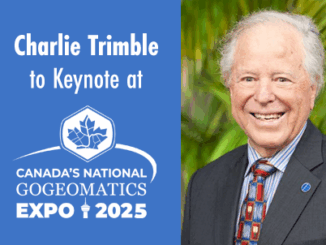
• facebook
  • Twitter
  • Linkedin
  • Youtube
  • Linkedin Group
  • Post a Job
  • Post an Ad
  • Post an Event
  • Post a Directory Listing
  • Post a Press Release
  • Media Kit
  • My Account
  • Login
GoGeomatics
  • MAGAZINE
    • BIM & GIS
    • Community
    • Conference news
    • Earth Observation
    • Education & Careers
    • GEOAI
    • Announcements
    • Reality Capture & Lidar
    • Science
    • Technology
    • Between the Poles
  • Directories
    • ASSOCIATION
    • INDUSTRY
    • EDUCATION
    • Open Data
  • EVENTS
    • GeoIgnite Events
    • Events Calendar
    • GoGeomatics Meetups
  • Services
    • Advertising
    • Marketing
    • Post a Job
    • Post an Ad
    • Post an Event
    • Post a Press Release
    • Post a Directory Listing
    • Media Kit
    • Web Design
  • Find a Job
  • Volunteer
    • Start a GoGeomatics Group
    • Editors & Writers Group
  • About Us
    • About Us
    • Contact Us
    • Frequently Asked Questions
  • Videos
Homeremote sensing

remote sensing

Lidar CANEX 2025 Panel:
Conference news

Lidar CANEX 2025 Panel: Exploring the Current and Future Landscape of Lidar Projects in Canada

26 February 2025 Alicia Schrader | Canada

A distinguished panel of experts from various sectors gathered at Lidar CANEX 2025, to discuss the evolving landscape of Lidar technology in Canada. The premier B2B online forum was held on January 29. LidarCANEX is Canada’s […]

No Picture
Conference news

Pacific Geomatics Joins GeoIgnite as a Bronze Sponsor and Exhibitor

26 February 2025 GoGeomatics Canada | business

Ottawa, Canada – Pacific Geomatics (PacGeo), a recognized leader in high-resolution satellite imagery solutions, is joining GeoIgnite 2025 as a Bronze Sponsor and exhibitor. With extensive experience in providing tailored geospatial solutions, PacGeo has supported […]

International-Digest-Feb-24|||||||
BIM & GIS

International Geospatial Digest for February 24, 2025

24 February 2025 Volunteer Editors and Group Writers | drones

US Signals Potential Changes at NOAA UConn Researchers Tracking Change in Precious Ecosystems New UN Report Offers Insights into how Geospatial Technology can Advance Global Food Security Lost Cities of the Amazon: Science is Revealing […]

Keeping it CLASS(y) and Having a BLAST with NV5
Conference news

Lidar CANEX 2025: Keeping it CLASS(y) and Having a BLAST with NV5

21 February 2025 Benedicta Antwi Boasiako | Airborne Sensing Technology

At Lidar CANEX 2025, NV5 made waves with their newest Lidar developments, introducing two innovative solutions aimed at solving real-world mapping challenges. The premier B2B online forum held on January 29, 2025, brought together experts […]

GeoIginte-USGIF-Association-sponsor
Community

USGIF Joins GeoIgnite 2025 as Association Sponsor

19 February 2025 GoGeomatics Canada | Canada

Ottawa, ON: GoGeomatics is pleased to welcome the United States Geospatial Intelligence Foundation (USGIF) as an Association Sponsor for GeoIgnite 2025, Canada’s geospatial leadership conference. As a leading organization in the field of geospatial intelligence (GEOINT), […]

Technology

International Geospatial Digest – February 10, 2025

10 February 2025 Volunteer Editors and Group Writers | Arctic Ocean mapping

USGS releases first-ever map of potential for geological hydrogen in U.S. India to Set Up National Geospatial Mission Scientists brace ‘for the worst’ as Trump purges climate mentions from websites Mapping the impacts of U.S. […]

Conference news

Natural Resources Canada to Participate in GeoIgnite 2025 and Lead Keynote Presentation

7 February 2025 GoGeomatics Canada | Artificial Intelligence

Ottawa, ON – GoGeomatics is pleased to announce the participation of Natural Resources Canada (NRCan) at GeoIgnite 2025, which is taking place from May 12-14, 2025, at the Ottawa Conference and Event Centre. NRCan’s contributions […]

BIM & GIS

US-Canada Tariff Tensions: Insights from Canadian Geospatial Industry Leaders

5 February 2025 GoGeomatics Canada | Canadian Geospatial

The escalating trade tensions between the U.S. and Canada, spurred by proposed tariffs, have sparked widespread concern across industries. For Canada’s geospatial and Earth Observation sectors, the implications are particularly significant, given their deep integration […]

Posts pagination

« 1 … 17 18 19 … 72 »

Events

Notice
There are no upcoming events.

View All Events

Services

  • Post a Job
  • Post an Ad
  • Post an Event
  • Post a Directory Listing
  • Post a Press Release
  • Media Kit
  • My Account
  • Login

Jobs

Post a Job
  • Volunteer Editorial Contributor – Be Part of Canada’s Geomatics Story
    Remote
  • Junior Geomatics Field Technician – Technical Surveys
    Montréal, QC
  • GIS Specialist
    Amherst, Nova Scotia
  • Precast Structural BIM Specialist
    Calgary, Alberta
View All Jobs
  • Directories
    • Associations Directory
    • Industry Directory
    • Education Programs
    • Open Data
  • Volunteer
    • Start a GoGeomatics Group
    • Editors & Writers Group
  • About Us
    • GoGeomatics Media Kit
    • Who We Are
    • Contact Us
    • FAQ’s
    • Advertising
    • Marketing
  • Subscribe
GoGeomatics
GoGeomatics is the largest and most popular communications hub promoting the Canadian geospatial community. The business was incorporated in 2011. GoGeomatics hosts over 100 fun, free, location technology networking events each year in cities across Canada.

© 2026 GoGeomatics

  • facebook
  • Twitter
  • Linkedin
  • Youtube
  • Linkedin Group