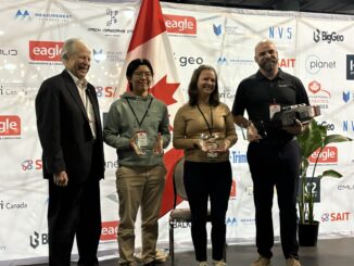
remote sensing

Balancing Innovation and Responsibility: Ensuring a Sustainable Space for Future Generations

Balancing Innovation and Responsibility: Ensuring a Sustainable Space for Future Generations

As humanity embarks on an ambitious journey into the cosmos, the need for sustainable practices in space exploration becomes increasingly…

NAIT Surveying and Geospatial Engineering Technology Students Join the Expo

NAIT Surveying and Geospatial Engineering Technology Students Join the Expo

Working with the next generation of Canada’s geomatics professionals has always been at the core of what GoGeomatics is all…

Canadian-digest-Oct-7-2024

Canadian Geospatial Digest for October 7th, 2024

An Era Ends with the Retirement of the Canadian Digital Elevation Model (CDEM) State of the Canadian Space Sector 2023…

Harnessing Earth Observation for Environmental and Industrial Sustainability in Canada

The 2023 State of the Canadian Space Sector Report highlights significant growth in Earth Observation (EO) technologies. In 2022, EO…

Canadian-digest-Sept 23

Canadian Geospatial Digest for September 23rd, 2024

An online map tracks Climate-related disaster cost. University of New Brunswick researchers participate in AI-based projects Living Lakes Canada Maps…

Mapping Human Impact

Mapping Human Footprint: Uncovering the Hidden Impact on Ecosystems in Canada

As human activities increasingly transform ecosystems, the pressure on biodiversity across Canada is growing. The diverse geography of the second-largest…

Canada’s 2023 Wildfires Released More Carbon in 5 Months Than Annual Fossil Fuel Emissions of Russia or Japan

We know Canada experienced its most destructive wildfire season ever in 2023, which single handedly drove a nearly a quarter of increase…

The CanSLAM Circuit

The CanSLAM Circuit: Advancing Geomatics Through Innovation and Collaboration

What an incredible time to be a mapping professional! Infrastructure the world over continues to change for the better (and…

Dive into the Latest in Reality Capture at the GoGeomatics Expo

From Alcatraz to Asset Management: Dive into the Latest in Reality Capture at the GoGeomatics Expo

The National GoGeomatics Expo 2024 is happy to present the Reality Capture & Digital Twin presentation track. We are presenting…

International Digest Aug 19, 2024

International Geospatial Digest for August 19, 2024

UZMA signed agreements with government authorities and organizations to enhance Malaysian geospatial services. UniSQ use geospatial data to help better…

The Public Good Program is Back at GoGeomatics Expo

The Geomatics for the Public Good program at the National Expo highlights how geomatics technology is being harnessed across federal,…