Technology
Canadian Geospatial Digest July 24th, 2023
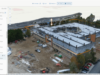
‘Incredible geo-cultural landscape’ is being mapped using a drone. FireSmoke Canada Interactive Map Sea ice in Hudson Bay is melting sooner than usual 2023 North American Indigenous Games to use advanced mapping technology. The 2023 […]