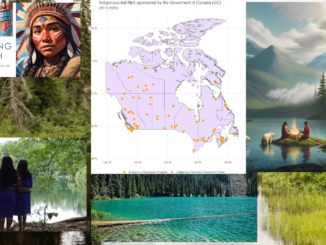
• facebook
  • Twitter
  • Linkedin
  • Youtube
  • Linkedin Group
  • Post a Job
  • Post an Ad
  • Post an Event
  • Post a Directory Listing
  • Post a Press Release
  • Media Kit
  • My Account
  • Login
GoGeomatics
  • MAGAZINE
    • BIM & GIS
    • Community
    • Conference news
    • Earth Observation
    • Education & Careers
    • GEOAI
    • Announcements
    • Reality Capture & Lidar
    • Science
    • Technology
  • Directories
    • ASSOCIATION
    • INDUSTRY
    • EDUCATION
    • Open Data
  • EVENTS
    • GeoIgnite Events
    • Events Calendar
    • GoGeomatics Meetups
  • Services
    • Advertising
    • Marketing
    • Post a Job
    • Post an Ad
    • Post an Event
    • Post a Press Release
    • Post a Directory Listing
    • Media Kit
    • Web Design
  • Find a Job
  • Volunteer
    • Start a GoGeomatics Group
    • Editors & Writers Group
  • About Us
    • About Us
    • Contact Us
    • Frequently Asked Questions
  • Videos
HomeSpatial Analysis

Spatial Analysis

Community

How GIS and Remote Sensing Validate Indigenous-Led Stewardship

14 January 2026 Alefiya Dungrawala | #GeospatialCommunity

For decades, the conversation around conservation in Canada has been dominated by a “fortress” model—federal and provincial parks managed by central agencies. However, a landmark study released on January 6, 2026, by researchers at Concordia […]

Community

Canada’s Most Impactful Geospatial & Geomatics Stories of 2025

1 January 2026 Volunteer Editors and Group Writers | 3D Mapping

As 2026 begins, the GoGeomatics volunteer and editorial team took time to reflect on the year just past and identify the Canadian geospatial stories and though leadership that mattered most in 2025. Together, these selections […]

Community

GoGeomatics Picks the Most Impactful Geospatial International Stories of 2025

1 January 2026 Volunteer Editors and Group Writers | AI-driven platform

As we welcome 2026, the GoGeomatics volunteer and editorial team is reflecting on 2025, a year of remarkable global progress in geospatial science and technology. To close out the year, we’re sharing our pick for […]

BIM & GIS

The Story Beneath the Map

19 November 2025 Benedicta Antwi Boasiako | cartography

People open maps on their phones every day to check a route, locate a place, or understand what surrounds them. It feels simple, but a long history stands behind that moment. The journey to modern […]

BIM & GIS

Cross-Modal Reasoning at Planetary Scale: The Rise of Google Earth AI

7 November 2025 Alefiya Dungrawala | BigQuery

As the planet’s challenges intensify, human innovation rises to meet them. However, unlocking timely and actionable insights from the vast volumes of Earth observation data demands more than traditional GIS platforms, which often face limitations […]

Professional journey
BIM & GIS

From Blueprints to BaseMaps: My Unexpected Journey into GIS from the World of Architecture

3 September 2025 Sree Vishnu Priya Donepudi | architecture

  When I first chose architecture, I imagined a future filled with site plans, 3D models, and the creative challenge of shaping spaces where people live and work. To me, it was more than drawings […]

EO and AI
Conference news

Emerging Trends in Geospatial and AI Innovation

29 May 2025 Bilyana Anicic | 3D Mapping

Recent advancements in geospatial and AI technologies are driving transformative changes across industries. These emerging trends, with a strong emphasis on collaboration and innovation, are unlocking new possibilities for addressing global challenges. Some of these […]

Conference news

From Data to Action: FHIMP and the Future of Flood Risk Governance in Canada

29 May 2025 Kruti Mehta | Canada flood maps

At GeoIgnite 2025, Maxim Fortin, Senior Engineer Advisor at Natural Resources Canada (NRCan), delivered a standout session on Canada’s evolving approach to flood hazard mapping. Representing the team behind the Flood Hazard Identification and Mapping […]

Posts pagination

1 2 … 9 »

Events

Notice
There are no upcoming events.

View All Events

Services

  • Post a Job
  • Post an Ad
  • Post an Event
  • Post a Directory Listing
  • Post a Press Release
  • Media Kit
  • My Account
  • Login

Jobs

Post a Job
  • Systems Analyst – Asset Management and GIS
    Yellowknife, Northwest Territories
  • Canada Maps and Poster Gallery Volunteer Leads — GeoIgnite 2026
    remote
  • Volunteer Editorial Contributor – Be Part of Canada’s Geomatics Story
    Remote
  • Senior Asset Management Technologist
    Grimsby, ON
View All Jobs
  • Directories
    • Associations Directory
    • Industry Directory
    • Education Programs
    • Open Data
  • Volunteer
    • Start a GoGeomatics Group
    • Editors & Writers Group
  • About Us
    • GoGeomatics Media Kit
    • Who We Are
    • Contact Us
    • FAQ’s
    • Advertising
    • Marketing
  • Subscribe
GoGeomatics
GoGeomatics is the largest and most popular communications hub promoting the Canadian geospatial community. The business was incorporated in 2011. GoGeomatics hosts over 100 fun, free, location technology networking events each year in cities across Canada.

© 2026 GoGeomatics

  • facebook
  • Twitter
  • Linkedin
  • Youtube
  • Linkedin Group